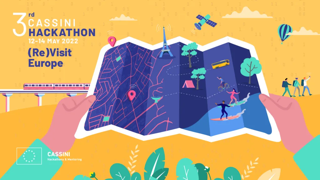
The third CASSINI hackathon is finally happening on May 12-14, 2022. This time the theme of the event is (Re)Visit Europe. The participants will help improve the tourism sector’s resilience, sustainability, and digitalisation. The EU and regional and national governments need your help to revitalise tourism and create new ways to access European destinations!
Your team will need to focus on developing ideas based on at least one of the following technologies:
- geospatial information from Copernicus Earth Observation data and its services
- positioning technologies from Galileo & EGNOS
- emerging digital technologies (e.g. machine learning, augmented/virtual reality or blockchain)
What are the challenges to be solved?
Each hacking team will need to select one of three challenges. The challenges require them to design products, devices or services with a specific goal:
Challenge #1: Finding sustainable destinations. Where to go and how to get there?
Design products, devices or services that reduce the carbon footprint of tourism travel. If you choose this challenge, you’ll be encouraged to dive into carbon footprint measurement of travel, understanding travel patterns between cities/countries, alternative destinations and modes of transport, online travel agents and other intermediaries and new, disruptive travel concepts.
Challenge #2: Experiencing cities and cultures. What to visit and who to meet?
Design products, devices or services that offer tourists a unique and sustainable experience of our cities and cultural heritage. If you choose this challenge, you’ll be encouraged to explore crowd management and slow tourism, personal recommendations and itineraries, social recognition and social media, state-of-the-art, virtual travel experiences and support local businesses and communities.
Challenge #3: Exploring nature with care. What outdoor activities to do?
Design products, devices or services that can help offer tourists a unique and sustainable opportunity to explore our nature. If you choose this challenge, you’ll be encouraged to focus on tourist information about the environmental state, conservation of local wildlife and biodiversity, generation of (new) routes, points of interest and activities, social recognition and social media and support local businesses and communities.
Where, when and how to participate?
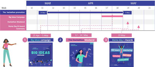
Local organisers will host all ten events delivered in a Hybrid off-site and on-side mode simultaneously in Austria, Denmark, France, Greece, Hungary, Italy, Netherlands, Norway, Poland, Portugal. Participation requirements include living in an EU member state, Switzerland, Norway or Iceland. You should register your team by the 5th of May..
Here is the timeline:

Is it worth it?
Hackathons are a great way to push your creative mind to develop extraordinary ideas in a short time. It’s just three days that can change your life and accelerate your career. You don’t need to be a great developer or geospatial expert. You get plenty of support from the experts during the event, but you need a solid drive to create great products or services that are enabled by space technologies. The hackathon is open to anyone with a passion for entrepreneurship, tourism, and EU space technologies.
Don’t wait up! Register your team here: https://hackathons.cassini.eu/


