#Ideas

“Access to Jobs Map” – mapping job openings in NY by commute

One of things you look at when searching for a job is your commuting time. When you think about spending 4h per day in getting to work if might be discouraging, tiring and at the end it might have a negative impact on your motivation and productivity. The day has only 24h. If you spend 10h at work, 4h on commuting, 7h on sleeping, there is not much time left… for living.

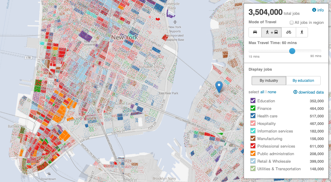
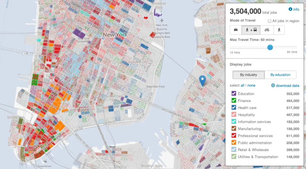
The projects called “Access to Jobs Map” is focusing on that issue and mapping jobs in NY by commute time. The project uses Leaflet, Census data, public transit data in the GTFS format, and OpenTripPlanner to build this cool interactive map.

Maps by Commute - Geoawesomeness

The tool allows the user to define the place of origin, mode of transportation (walking, biking, public transit or car) and maximum travel time. The map shows a single point for each job that meets the selected criteria. Jobs are colour coded by either industry classification or education of the employee wanted.

I must say that the map is simple but useful. Useful for both job seekers and employers who might use it for example to offer more flexible working hours or home office options for their employees. For me it also shows another cool map project developed with Leaflet. Cool stuff.

Say thanks for this article (0)
The community is supported by:
Become a sponsor
#Ideas
#Business #Fun #Ideas #Science
Next Generation Map Navigation: Is It Based on AR Smart Glasses?
Nianhua Liu 07.19.2024
AWESOME 2
#Business #Fun #Ideas #People
History of GIS | Top 6 Figures in GIS and Geospatial
Nikita Marwaha Kraetzig 08.12.2024
AWESOME 2
#Business #Featured #GeoDev #Ideas #News
Bee Maps: Creating a Buzz in the World of Fresh, Affordable, and Real-Time Mapping Solutions
Nikita Marwaha Kraetzig 11.5.2024
AWESOME 3
Next article
#Business

Facebook acquires activity-tracking app Moves

flat-storyline-full-ukLast week Facebook announced it is buying Moves – daily activity and fitness tracking app. In a blog post, the Finnish startup said it will be working on Facebook’s own products and services, but refrained from giving any specifics. Does it mean that Facebook is getting into sports and wearable tech hype? I don’t think so.

PASSIVE LOCATION TRACKING

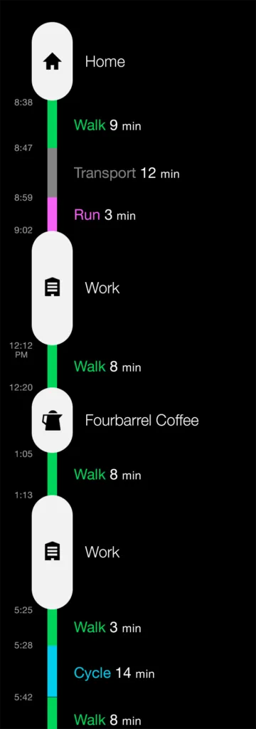
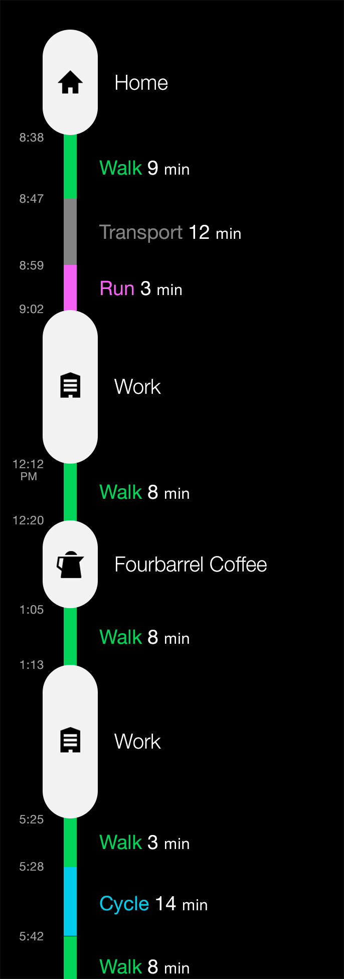
What’s different about Moves from any other location-based sports tracker? It uses passive location tracking in a background of the phone without draining the battery. The idea is to use all several sensors of our phone to automatically recognise whether we’re walking, bicycling, running or anything else. And this is the key.

Google and Apple are both studying and recording our daily behavioural patterns to provide more personalised services and better target ads. Facebook has even more personal data about each of us. By adding another layer of information to our user profile , the company could gain some competitive advantage over Google. There are start-ups like Locomizer who openly says: tell us where you are, we’ll tell you who you are. Taking even broader approach and incorporating data about our daily movement patterns gives a lot of important targeting information. And in case of Facebook possible access to data of over 1 billion users world-wide.

FACEBOOK AND LOCATION = ?

What will the Moves team work on at Facebook? Mark Zuckerberg himself might not be fully sure about it but the message is clear: Facebook understands that its underutilising the location-based potential of the data and they want to make a better use of it. And they are quite open about it. 2,5 years they bought Gowalla, and several other start-ups like e.g. Glance, 1,5 years ago they’ve launched Nearby – for local places discovery, and last week new feature called Nearby Friends.

Of course there is an important issue of our privacy. Will we be willing to share our daily routine with Facebook? Or it’s better to say our “location-based daily routine” as we already share a lot of personal stuff with FB. This is something that each of us should be aware of. Personally I don’t mind it…yet.

Read on
Search