In the age of GPS, navigating in a new area is a piece of cake. All you need is a smartphone or a PND and an address. Now which one of the two, do you think is the more troublesome part? Hint: It has nothing to do with a battery.
Addressing the world with 3 words!
One of the everyday life things that a vast of majority of us take for granted – is a proper postal addressing system. Over 2/3 of the countries in the world lack a proper address system and this means millions and millions of people are living without one of the most fundamental metadata about ourselves – address!
What3Words is changing that with 3 words and to learn more about that I spoke to Gary Gale, the CTO of W3W (and a GeoGeek in every sense of the word). Let’s dive right in!
You have extensive experience in the Geo world (BBC, HERE, Yahoo, Ordnance Survey…) and are a #GeoGeek. You have been with W3W since July this year, how did Chris (CEO of W3W) manage to get you onboard to change the world with a new addressing system?
To be honest, I didn’t “get” the concept at first. My head was firmly in the space of “we don’t need another unique geographic identifier”.
But then shortly after I first met Chris, I went to India for a week and found myself at Indira Gandhi International Airport in New Delhi trying to explain to a taxi driver that the address of my hotel was “Ring Road, New Delhi”.
Then I got the concept.
The journey which should have taken 35 minutes took two and a half hours. We were constantly stopping to ask for directions along the way and I was never really sure if we going to the right place. A fellow geo-geek at the GeoBLR meeting in Bengaluru later joked to me that in India, GPS often stands for General Populace System!
Since that day I watched what3words grow, saw the potential applications in both developing and developed countries for both individuals and businesses.
When Chris approached me I jumped at the chance to join the team as CTO. The opportunity to change the world with 3 simple words was just too great to resist.
Looks like India also provides answers to “GeoGeek” questions 😉 Haha! Speaking of answers, Why 3 words and why 3×3 meter. Was it all planned or just a coincidence?
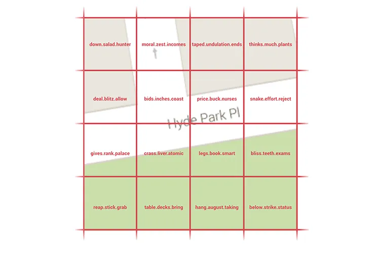
3mx3m is precise enough to meet the vast majority of use cases. There are 57 trillion 3mx3m squares in the world. With a word list of 40k dictionary words it takes just 3 words to allocate each one of those square a unique address.
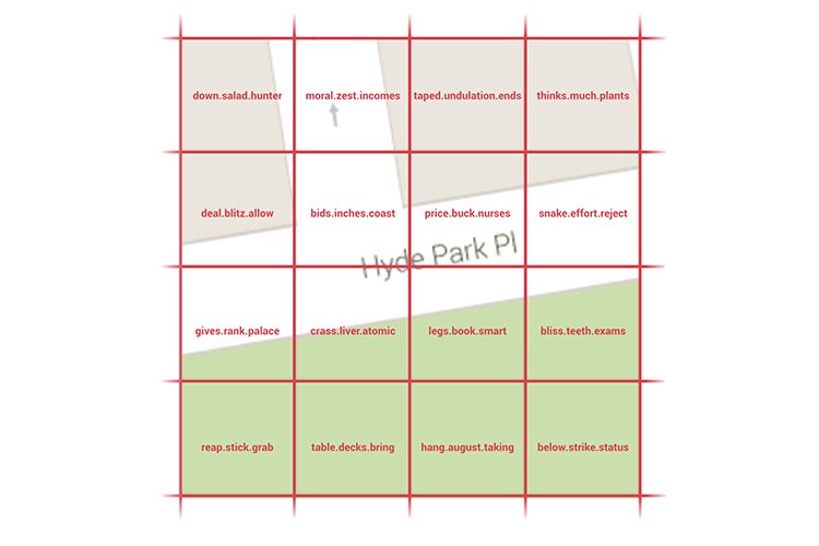
W3W – Addressing the world with 57 Trillion Grids ©2015 Copyright what3words
(Basically 40,000 cubed is 64 trillion so there is enough with some spares.)
Any smaller granularity than 3mx3m would dramatically increase the number of squares and mean a much bigger word list, which is challenging in some languages, or more words to define a location. Any larger than 3mx3m and you increase the possibility for ambiguity or loss of precision.
People’s ability to recall 3 words long enough to tell someone else or write it down is near perfect. When you compare that to the percentage of people able to recall a 10 digit alphanumeric string and it falls to less than 10% and for a 16 digit lat/long it is as close to zero as makes no difference.
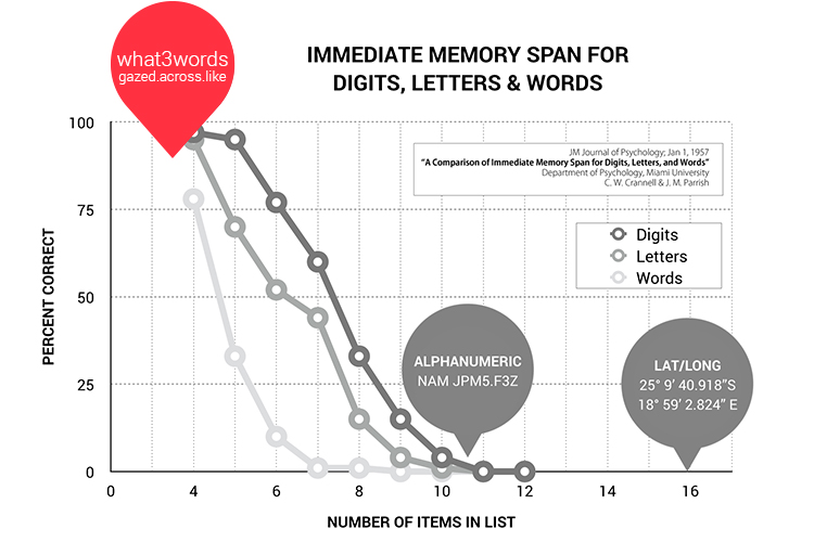
How much can you remember? ©2015 Copyright what3words
A 3 word address is a geographic reference system for humans which works really well with computers, rather than most of the other geographic references which are hard to parse for humans (think address recognition in geocoders) or hard to use for humans (think coordinates).
Do you see W3W co-existing with other address systems and if so, how exactly?
One of the biggest misconceptions out there is that the world is well addressed. It isn’t.
what3words is a geocoder for the entire world that isn’t tied to any one use case. It is a simple way for everyone to refer to any location.
In the classic definition of a postal address we can augment any existing system to improve efficiency and customer satisfaction in both developed & developing countries.
The UPU states that over 75% of the countries in the world either have a poorly maintained addressing system or no street addressing system at all. We can help by giving everywhere an instant working address.
In the 25% of the world with well maintained systems we can add a level of specificity for those times when it just doesn’t work or is not accurate enough. For example 0.5% of deliveries fail in the UK annually due to poor addressing. That doesn’t sound much but that 0.5% comes with a cost of around £770 million.
And of course we provide a simple address for things which people need to locate but which will never have a postal address because people don’t live or work there, such as fixed assets, meeting friends at a festival or specifying the site of a car breakdown.
what3words co-exists with other addressing systems, in ways which people instinctively grasp as well as in ways that they might not immediately think of.
What’s the focus at W3W in terms of revenue?
what3words is a tiny piece of code, an API or SDK that plugs into existing businesses’ apps and services and works across a range of platforms and devices. We charge businesses for access.
what3words will always be free for individuals to use on our site and apps. We support fair and equitable use and employ a structure that provides qualifying organisations, including humanitarian and not-for-profit entities, with a range of free and discounted usage plans.
In the age of Big data, your focus as the CTO of W3W is “Geographic little data”, could you explain your work and vision for W3W?
Despite the fact that we live in an online, connected world where we have cheap and easy access to fat data pipes at home, at work and out and about, not everyone is as lucky. Traditional geocoders are almost the archetype of big data; they need lots of data, updated regularly, and dedicated server farms to work on that data.
The what3word core SDK is the complete inverse this; we have a forward and reverse geocoding system for 3 word addresses that literally works out of the box, globally and offline; there’s no need for a data connection. That’s a very powerful ability which I’ve clumsily characterised as “the reverse of big data”.
Right now I’m focusing on building out our technology base, online, on mobile and on the back-end to allow us to scale effectively and to meet the demands our users rightfully expect of us. We’ve got a dedicated and committed commercial team who are driving our revenue program forwards, but for now, my focus is to make our technology work harder, faster and better and to build the products that our users, current as well as future, want to use.
As a GeoGeek CTO, do you think Indoor positioning is advanced enough for W3W to enter the market to provide a new address system?
Almost the entirety of the location industry works from a system that was devised in 1973 and started in 1978 as a military tool. It wasn’t until 2000 when GPS selective availability was switched off that the explosion of maps and location services we almost take for granted started to emerge. All of this is based on one single, global, widely used and accepted system. We’re not at that stage with indoor positioning, we’re not even at the stage that video cassettes were at when the battle of VHS vs. Betamax happened. There’s massive strides and progress being made with indoor positioning but for now, I’m keeping my eye on what develops to see how and if we can incorporate that.
Lack of proper address system are a big issue in the developing world, in that sense W3W is truly making the world a better place. Is there a way we #GeoGeeks can help you in that journey?
Absolutely. At the simplest level, you can download and use our mobile apps for iOS and for Android and share the way in which you use 3 word addresses on a day to day basis. That’s a very simple way of helping but an incredibly accessible and powerful one.
If you know how to code, then use our API or SDKs in ways we haven’t thought about yet and let us know about it. The geo developer community is incredibly good at coming up with ways of using technology that make us very happy!
And if you see a place where our technology can make a difference, let us know.
Your OpenStreetMap article on GeoHipster kicked off a storm. Any comments on that article?
The poet John Lydgate once said “You can please some of the people all of the time, you can please all of the people some of the time, but you can’t please all of the people all of the time” and that’s very much true of the OSM community. There’s a vocal component to this community which wants OSM to be the way they want OSM to be. There’s another even more sizeable sub community who just want to get on with making maps and helping people with the data they contribute to and the services they build on top of that data.
I wrote that article with my eyes as wide open as I could be. I expected some, ahem, vigorous discussion and debate on the topic and wasn’t disappointed in that. But I was also greatly heartened by the amount of support that article engendered; lots of people got in touch to say that agreed with some of what I wrote, but not all of it. Which I think makes Legate’s quote all the more applicable. It definitely pleased some people some of the time.
As an experienced geo professionals, whats your advice for new grads and young professionals?
Learn to code. It doesn’t matter whether it’s a more traditional language like C++ or Java or a scripting language like Python, Ruby, Perl or PHP. What matters is that you have a decent grasp of how to write and structure code. Once you have one language under your belt, getting to grips with the peculiarities of another will be far easier than from a standing start.
Learn to code. It doesn’t matter whether it’s a more traditional language like C++ or Java or a scripting language like Python, Ruby, Perl or PHP. What matters is that you have a decent grasp of how to write and structure code.
Not only will this serve you well for the rest of your career, but you will almost certainly come to a point where it’s either quicker to write some code to get a job done rather than using an off the shelf software package or what you want to do just isn’t possible with one of those off the shelf packages.
What does the Crystal ball show you for the spatial industry in 2016?
More geodata from more sources being used in more ways. And not just from the geo industry itself.
Throughout this year we’ve seen clever and innovative uses of geo from people and companies who would never say they were geographers or in the geo industry. Long may that continue.
Throughout this year we’ve seen clever and innovative uses of geo from people and companies who would never say they were geographers or in the geo industry. Long may that continue.
And of course what3words as a globally recognised way to communicate location.


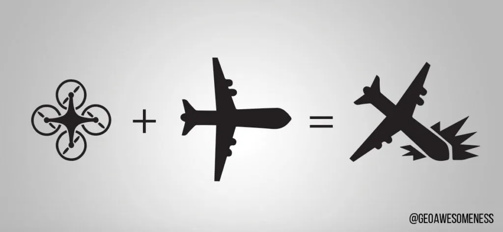
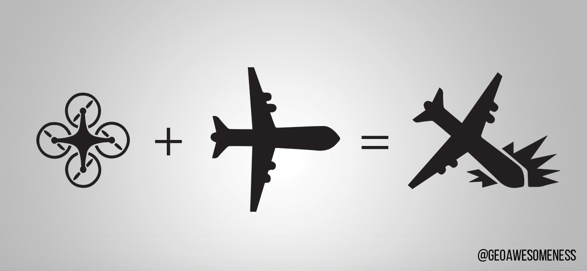
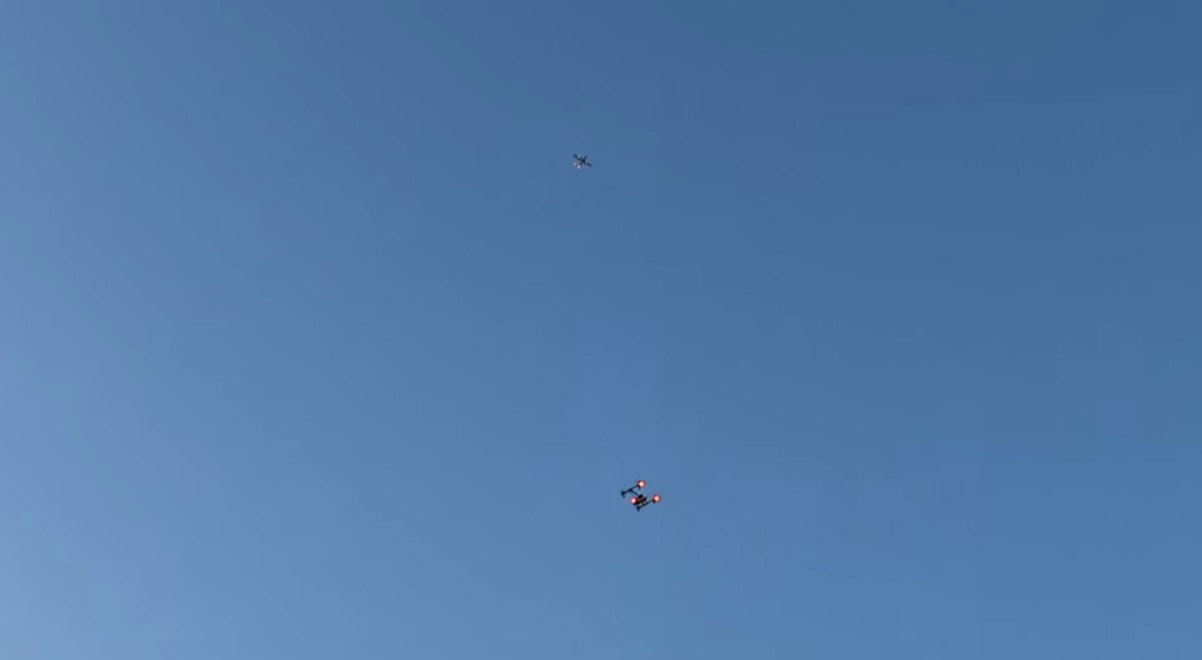
 The future of the drones and drone usage is vague. Some people believe that the government rules will get stricter and that those rules will reduce the drone usage. The government might also see a threat to security in drones since they are flying objects with which you can do literally anything.
 There are two other branches of drones. Agriculture drones, used for agriculture are also gaining popularity. And here are also military drones, which are more evolved than commercial ones and are used in military operations where they replace humans. That is certainly a useful thing for military as this reduces casualties. But there is a fear which I already described – that military technology might be transferred to commercial drones. That might kill the whole commercial drone usage.