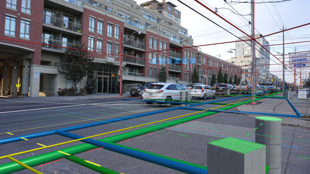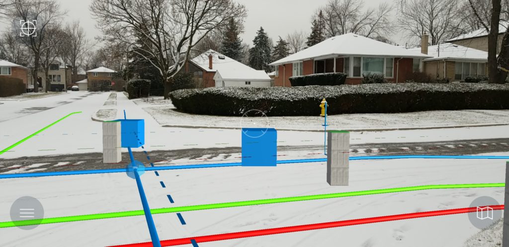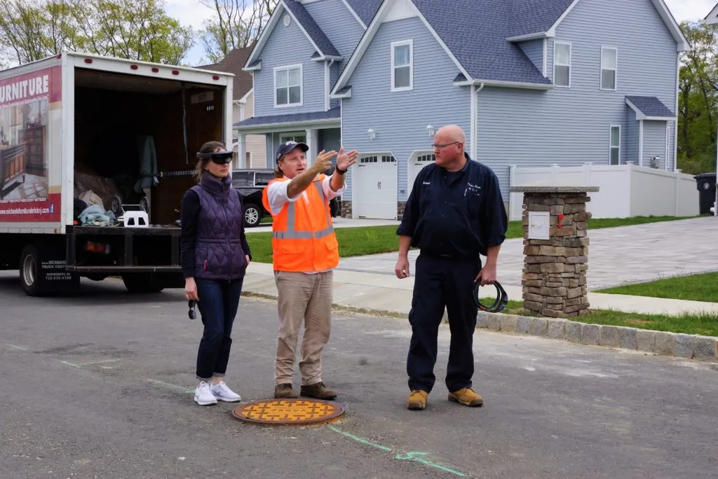
All modern towns and cities have extensive and complex networks of underground facilities – water, sewer, or natural gas, telephone, and fiber-optic lines. As more facilities go underground, the underground network becomes more complicated, making accurate identification of each more difficult. Since utility workers are unable to see buried assets directly, they rely on maps and information provided by others, and some of that information is antiquated or inaccurate. This often results in unintended damage to buried lines. According to Canadian Common Ground Alliance, undertaking a digging project without the knowledge of where underground infrastructure is located, is the most frequent cause of damage to buried infrastructure. That damage is estimated at $6B annually for North America alone.
This is where vGIS comes in! vGIS Utilities grants companies with underground assets an age-old wish: to see through the ground. Had the opportunity to chat with their founder, Alec Pestov, to learn more about their product, their vision, and their business model. Read on!
Q1: Alec, thanks for taking the time. You graduated with an MBA in strategic management and worked for a decade in a consulting company. What made you take the leap of faith and start a company that brings visual GIS solutions to the workplace? Looking back at it now, how do you connect these dots?
Actually, there is a natural progression. Early in my career, I dreamt of designing video games. My passion was 3D modeling and design, and I always marveled over well-done games, 3D art and CGI effects in videos – the power of taking 3D shapes and combining them into complex models to achieve visual perfection never ceased to amaze me.
After graduating from the MBA school, I launched my first company, which was a management consulting practice. Helping companies optimize their operations exposed me to hands-on do’s and dont’s of running a business.
Two startups later, I finally stumbled across an opportunity to combine my technical knowledge, management consulting experience and passion for 3D visuals to address real-life problems. Our team, which by that time had extensive experience with visualization tech and complex system development, engaged with a group of GIS experts who provided necessary industry insights for building the first version of vGIS, and the rest is history.
Q2: vGIS is creating visual (GIS) solutions for the workplace. Setting aside the hype about AR/VR, what does this mean to today’s workforce? How does your product help them?
Although the AR/MR/VR space tends to get quite hyped up, there is a lot more to it than just the hollow excitement.
Imagine, for a second, that you can have all the answers when you need them in the easiest to understand format without putting any effort into obtaining them. For instance, you see a jet in the sky and wonder where it is going. As you are thinking about it, the jet lightens up to make it more visible, its flight path is drawn overhead, and a small pop-up bubble appears beside it telling you everything you wanted to know about it. That’s the power of AR. When applied to industrial use, it transforms from mere curiosity to a powerful productivity and safety tool.
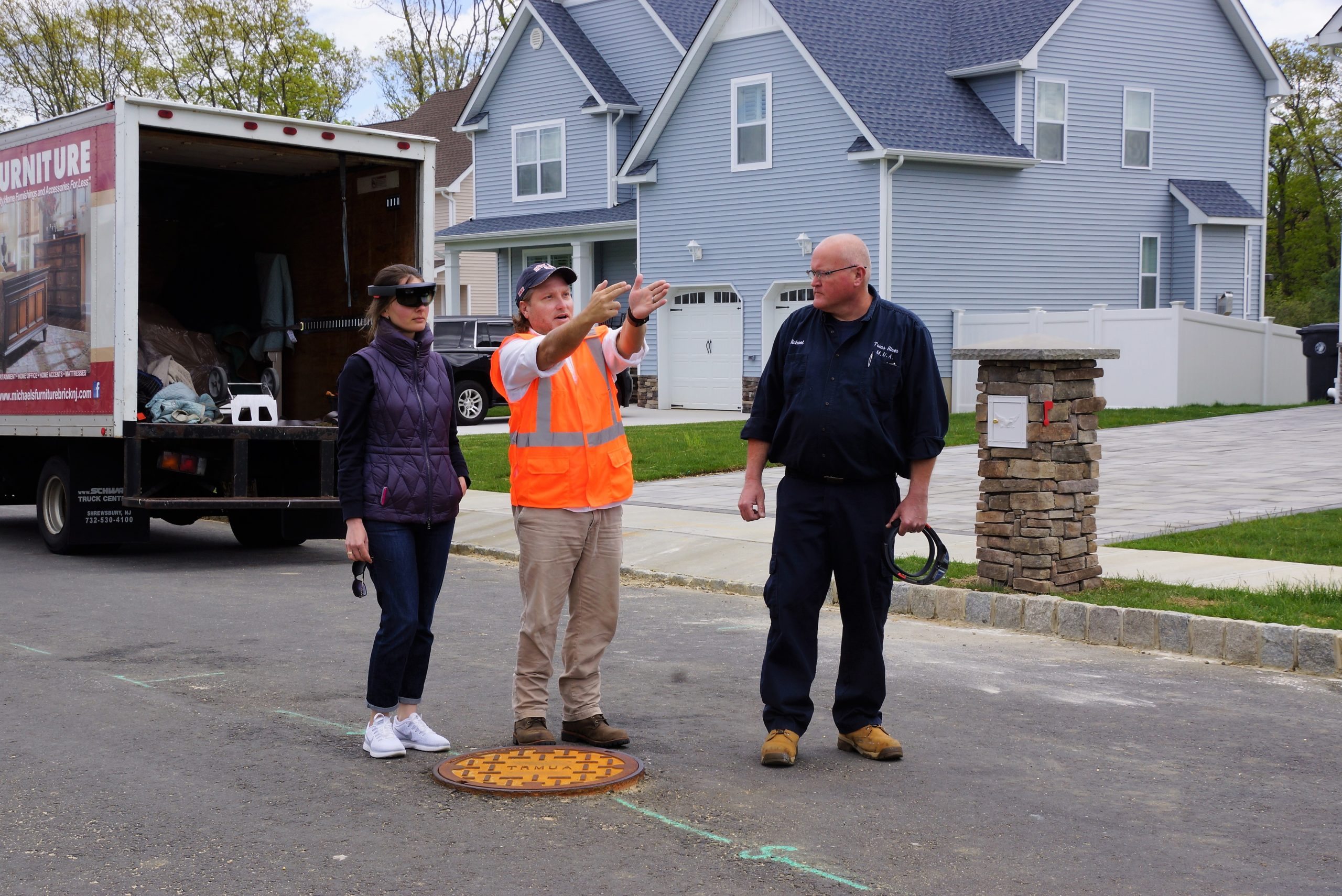
The future of workplace is in the convergence of many technologies. AR will play a major role in it. For us, that future is here. vGIS Utilities already lets its users see what they need to work on while remaining hands-free, thanks to Microsoft HoloLens. vGIS also works on consumer devices, such as iPhones, iPads, and Android, so you can carry access to the wealth of information right in your pocket.
Our vision for vGIS can be summarized in two words: visual and practical. We value quality User Experience and User Interface and pay close attention to make sure our products are beautiful and easy to use. At the same time, we realize that our products need to solve a set of very specific problems, and we concentrate on making vGIS highly practical. This focus drives our approach to evolve the system, and it seems to resonate well with our clients.
Q3: It is quite easy to understand the benefit of AR/VR solutions for utility companies that have kilometers and kilometers of buried pipelines. That being said, how difficult was it to convince these companies about your product? What were the challenges there?
Many organizations have already understood the importance of bringing modern technology to their operations, and our current target demographics are the early adopters and the early majority. We find that in most instances, those who thought about Augmented Reality in field services do not require convincing. The benefits of the AR tools are self-evident.
For the skeptics and new users, it mostly takes one field trial with vGIS – the system explains itself.
Q4: Developing an AR/VR app for an enterprise customer who is relying on your product is a completely different ball game compared to developing an app for fun. I’m sure you guys had your fair share of bugs and improvements that you had to work on. What was the biggest engineering challenge so far in developing vGIS?
[Laughing] The challenges are endless, which is a curse and a blessing at the same time. We are the trailblazers of the space. 30% of tech we use in vGIS did not exist a year ago, 75% did not exist 2 years ago. So we are literally at the forefront of innovation.
Being the first comes with its set of challenges. We have to work through not just our bugs, but also bugs of complementary software and the underlying platforms. We are still very early in the game, so often we need to develop solutions for the problems arising not from our software, but from 3rd-party components, such as rendering engines and AR frameworks.
We also have to address other common issues, such as accuracy, positioning, etc. It is tough, and our team spends at least 60% of its time on R&D and developing small improvements that make the system just a little more accurate, a little more stable, a little more precise.
This is also a blessing. If it was easy, someone would have solved a long time ago. Through the process of developing solutions to challenges no one dealt with before, we generate our own unique industry “know-how” and intellectual property, which gives us an edge.
Q5: vGIS supports Esri and CAD data currently, do you plan to support more formats and GIS platforms in the future?
We already support a variety of formats, including ArcGIS, KML, Shapefiles, etc. And we are constantly expanding our compatibility.
In 4-6 weeks we are expecting to release a beta integration with Bentley Software (first in the world), and from there on we plan to add more. Our vision for vGIS is a solution that generates unified AR visuals in the field from a multitude of sources, thus making it easier for our clients to integrate vGIS into their operations.
Q6: Could you tell us a bit more about your tech stack? What programming languages and technologies does your team use?
We standardize our system around specific technologies, rather than creating a patch-work of disjointed components. Our core is Microsoft Azure and .NET. The client application is done using Unity engine, which helps us cover a diverse variety of devices and make the system portable to new hardware platforms with minimal effort.
Q7: Would you consider vGIS a “GIS” company? What advice would you give to geography/geomatics students looking to work with vGIS?
We think of ourselves as a visualization company first. However, we are a visualization company that works on visualizing spatially-referenced data exclusively. So there is no way for us to disconnect from GIS – that’s our core.
GIS is an important field, and it is the field that has a bright future. As devices and services become more spatially aware, umpteen GIS-powered products will come to light, and all of that will require knowledge of GIS. Our advice is to learn GIS and keep an eye on the “cool tech” – drones, mobile, LiDAR, etc. It all comes together at some point, opening up new opportunities.
Q8: You are part of the Esri emerging business partner and the Microsoft partner program, in your experience how helpful are these programs by large multi-billion dollar companies to a startup? Were you ever concerned that Esri could potentially develop a similar solution and cut into your growth?
Both Microsoft and Esri have programs to nurture startups. The programs from these two companies specifically (unlike many other startup programs out there) are not gimmicks, they do work. We received tremendous support from both partners – technical advisory, technology access, subscription services, marketing, and sales support, you name it. Looking back, I can confidently say that we wouldn’t be able to get as far without their help.
For any startup, there is always a risk of being crushed by an established player releasing their own product. You have to remain sensitive and attentive to the developments in the industry, not just from the partners, but new entrants and other startups. The key is to differentiate and offer unique value.
Q9: Where do you see vGIS 3 years from now? What do you think is going to be your biggest challenge in the year(s) to come – raising capital, growing your team, finding more clients?
Startup life is unpredictable. 3 years ago, our team had no idea that we will be doing what we are doing now, and I am positive that any 3-year prediction or plan we make today will be invalidated in a few months. Despite that, we have our thought, goals, and plans.
Our objective is to master the AR visuals for field services and other industries that can benefit from visualizations of spatially-referenced data. This is a growing field, and as long as the technology outlook for AR doesn’t take a nosedive (e.g., a highly unlikely event of Apple, Google and Microsoft announcing withdrawals from the AR space), we see that there is plenty of potentials.
Q10: You are based in Ontario, Canada, how’s the startup scene? Are there many investors specifically looking at geospatial companies? Are there any local meetups/events that cater to the geo-community?
Ontario has a highly vibrant startup community. Although, the investment landscape is different from the Silicon Valley, there is plenty of talent, especially in the visualization space. In fact, in addition to Vancouver and Montreal, Toronto is among the top places in the world when it comes to 3D, CGI, video game talent. This makes is easier for a company like vGIS to grow.
Q11: Okay, this is a tricky one – on a scale of 1 to 10 (10 being the highest), how geoawesome do you feel today? 😉
Although startup life makes you transition from -10 to +100 (on a scale from 1 to 10) in a matter of minutes, when it comes to geoawesomeness we are consistently at 11.
Q12: Any closing remarks for anyone looking to start their own geo startup?
Stay “geoawesome” and good things will come to you.
If anyone would like to reach you, what would be the best way to do so?
www.vGIS.io and info@vGIS.io. Or Alec Pestov – alec.pestov@vgis.io
The Next Geo is supported by Geovation:
 Location is everywhere, and our mission is to expand its use in the UK’s innovation community. So we’re here to help you along your journey to success. Get on board and let’s start with your idea…
Learn more about Geovation and how they can help turn your idea into reality at geovation.uk
About The Next Geo
The Next Geo is all about discovering the people and companies that are changing the geospatial industry – unearthing their stories, discovering their products, understanding their business models and celebrating their success! You can read more about the series and the vision behind it here.
We know it takes a village, and so we are thrilled to have your feedback, suggestions, and any leads you think should be featured on The Next Geo! Share with us, and we’ll share it with the world! You can reach us at muthu@geoawesomeness.com or via social media 🙂


