
AI is advancing at an unprecedented rate, and its transformative power is reshaping nearly every sector, including our own. From predictive analytics to automated feature extraction, Artificial Intelligence is fundamentally changing how we collect, process, and understand geospatial data.
For many, the constant influx of news about these technological breakthroughs can feel overwhelming. The desire for a deeper understanding and expert-led discussion on the topic has never been greater.
That’s why Geoawesome is thrilled to announce a new series of digital events designed to help our community navigate this exciting landscape. Starting in September, this five-part series will bring together leading experts to deep-dive into the critical topics defining the future of AI & Geospatial (or GeoAI, if you prefer).
Each one-hour event will focus on a different, cutting-edge topic, featuring a presentation followed by an interactive Q&A session. To foster a collaborative environment, we will also organize breakout rooms at the end of each session for you to network, exchange ideas, and document your questions for future events.
This series is made possible with the generous support of our friends at Kili Technology, who share our passion for fostering trusted information and innovation in the geospatial industry.
Join us as we explore:
- Foundational Models: The new building blocks for GeoAI. (Monday 29th September, 2025)
- AI & Geospatial in the Financial Sector: The impact of AI on corporate reporting, ESG, and investment. (Watch the full webinar on demand)
- Integrity, Trust, and Provenance: Ensuring the reliability and ethics of AI-driven geospatial data. (Monday 13th October, 2025)
- Collaboration & GeoAI for Good: Leveraging GeoAI for humanitarian and environmental applications. (Monday 3rd November, 2025)
- State of the Industry: A look at the key trends and future direction of GeoAI. (Monday 1st December, 2025)
Do you have expertise in one of these areas and are interested in speaking? Or do you have specific questions you’d like to see addressed? Please reach out to muthu@geoawesome.com.
We hope to see you there! To stay informed about registration links and new details as they are released, be sure to sign up for our newsletter.
Further reading
“At Kili Technology, we’ve always believed that the progression of AI lies in high-quality, trustworthy data. Our data-centric platform helps organizations build reliable datasets for AI applications across finance, defense, healthcare, government, and other sectors. As increasingly powerful models and technical advancements accelerate geospatial use cases, high-quality data remains essential to their success. And so we believe Geoawesome’s digital series couldn’t be more timely, and we’re excited to participate in and encourage these important conversations about the future of responsible GeoAI development.” Michaela Nadine Pacis, Marketing Manager, Kili Technology.


#GeoAI


Next article
Remote sensing allows us to observe Earth like never before — from tracking deforestation in the Amazon to monitoring city growth from space. But for many, the world of remote sensing can feel buried under a mountain of acronyms, confusing image types, and pixelated data.
Here we want to help in understanding remote sensing imagery, explaining core concepts, data formats, and where you can explore this data for free.
What is Remote Sensing?
Remote sensing is the science of obtaining information about objects or areas from a distance, typically using satellites, drones, or aircraft equipped with sensors. Instead of physically touching or measuring things on Earth, remote sensing collects data through the detection of reflected or emitted energy, usually electromagnetic radiation.
Remote sensing vs. Earth Observation
Although these terms are often used interchangeably, they do have slightly different focuses:
- Remote Sensing (RS) is the focus on the technology and methodologies employed to collect data from a distance (e.g., satellites, drones, airborne sensors). It covers the physics behind sensors, data acquisition, and image processing.
- Earth observation (EO) is the process of acquiring information about the Earth’s surface and atmosphere through remote sensing technology. EO is about using these datasets to monitor environmental change, manage resources, or support decision-making.
In short:
🔹 Remote Sensing = How we collect the data
🔹 Earth Observation = How we use the data
Understanding Remote Sensing: An Overview by Geoawesome
Useful Free Dataset Links:
- USGS EarthExplorer — Landsat, aerial imagery, DEMs
- Copernicus Browser — Sentinel-1 SAR, Sentinel-2 multispectral
- NASA Worldview / NEO — Daily MODIS/VIIRS raster feeds
- OpenAerialMap — Community-sourced UAV rasters
- Google Earth Engine (GEE) — Landsat, Sentinel, MODIS, CHIRPS, and hundreds more
- Alaska Satellite Facility (ASF) DAAC — SAR (Sentinel-1, ALOS, RADARSAT-1, NISAR in the future)
- Earth Data Search — NASA’s full catalog interface
- SpaceNet on AWS – High-res labeled satellite data for ML
- Google Dataset Search – Search for published EO datasets across sources
Resolution Matters: GSD, Temporal, and Spectral
Spatial Resolution / GSD (Ground Sampling Distance)
Refers to the size of each pixel on the ground.
- Landsat 8: 30m GSD
- Sentinel-2: 10m in visible/NIR bands
- PlanetScope: 3–5m
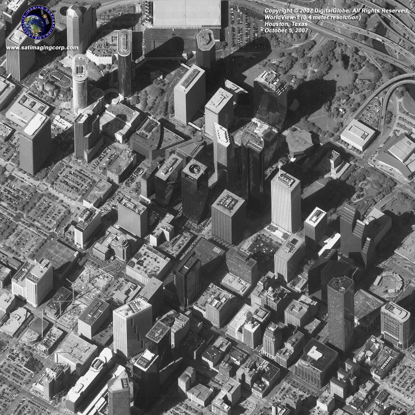
- WorldView-3: up to 0.3m (commercial)
Temporal Resolution
How often a satellite revisits the same location.
- MODIS: Daily
- Sentinel-2: Every 5 days (with both Sentinel-2A and 2B)
Spectral Resolution
The number and width of spectral bands.
- Multispectral (e.g., Sentinel-2): ~13 broad bands
- Hyperspectral (e.g., EnMAP): 200+ narrow bands
Example: Sentinel-2 false-color images often display vegetation in bright red using the NIR band — a useful trick for forest monitoring.
Satellite Remote Sensing: Understanding Resolution Types by Geoawesome
Image Types: Multispectral, Hyperspectral, Panchromatic, and SAR
🔹 Multispectral Imagery
Captures data in 3–15 broad bands across the spectrum.
Example: Sentinel-2, Landsat 8, PlanetScope
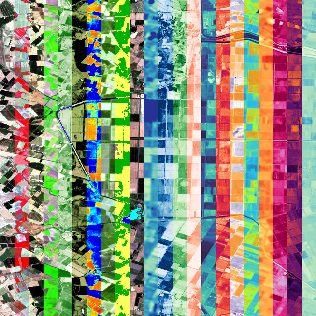
🔸 Hyperspectral Imagery
Captures data in hundreds of very narrow bands.
Used for: mineral exploration, precision agriculture
Example: PRISMA, EnMAP, AVIRIS
⚫ Panchromatic Imagery
Single-band grayscale image, but with very high spatial resolution.
Example: WorldView-2 Panchromatic (0.46 m)
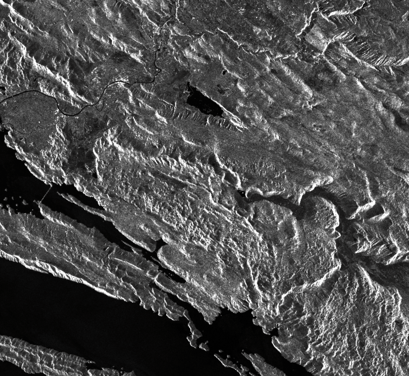
⚪ SAR (Synthetic Aperture Radar) Imagery
Active microwave sensor that captures data regardless of weather or daylight conditions. Used for: surface deformation, flood mapping, forest biomass, and sea ice monitoring. Example: Sentinel-1, RADARSAT-2, TerraSAR-X. Read more.
Where to Explore Remote Sensing Imagery
The best part? Much of this data is freely available and easy to access with no prior experience.
Platforms for Visualization
- Sentinel Hub – EO Browser
Explore Sentinel and Landsat data, compare dates, apply indices like NDVI. - NASA Worldview
Near-real-time MODIS and VIIRS imagery, overlays for fires, dust, storms. - USGS EarthExplorer
Download full scenes of Landsat, SRTM, and more. Includes metadata. - OpenAerialMap
Crowdsourced UAV imagery is perfect for humanitarian work or local mapping. - Google Earth Engine
For advanced analysis with code, free for research and nonprofits.
Understanding the building blocks of remote sensing—pixels, bands, and resolution—opens up a world of possibilities. With free platforms and data sources at your fingertips, now is the perfect time to explore Earth from above.
Explore More:
How do you like this article? Read more and subscribe to our monthly newsletter!
“At Kili Technology, we’ve always believed that the progression of AI lies in high-quality, trustworthy data. Our data-centric platform helps organizations build reliable datasets for AI applications across finance, defense, healthcare, government, and other sectors. As increasingly powerful models and technical advancements accelerate geospatial use cases, high-quality data remains essential to their success. And so we believe Geoawesome’s digital series couldn’t be more timely, and we’re excited to participate in and encourage these important conversations about the future of responsible GeoAI development.” Michaela Nadine Pacis, Marketing Manager, Kili Technology.

