Historical images are a priceless source of geographic data, they recorded the past landscape with a high resolution when satellite images were not available. Unfortunately, at this time, GPS geotags did not exist either. As a result, the only geographic information about historical images is generally an ambiguous place name which is not sufficient to properly register the images and extract their geographic content.

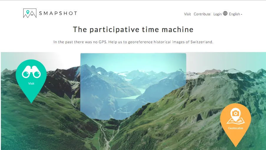
smapshot uses the power of the crowd to accurately georeference the images in a virtual globe. The virtual globe is fed by 3D data from the Swiss Federal Office for Topography. To georeference an image, the volunteers have to click on similar points in the image and in the virtual globe. These 2D-3D correspondences are the well known Ground Control Points (GCP) required in photogrammetry to compute an image’s orientation.
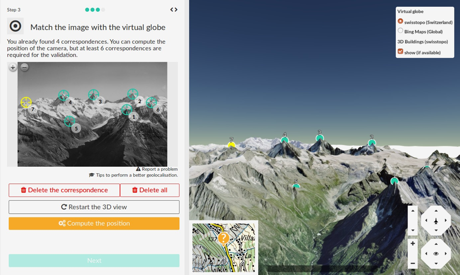
Digitisation of the 2D-3D correspondences in smapshot
When an image is georeferenced, it is inserted as a 3D object in the virtual globe. There is a two-step validation. First, an error on each GCP is computed, if the maximal error is above a threshold, the geolocalization can’t be validated by the volunteer. Second, the archivists who provide us with the images check visually the alignment. In this way, they ensure that the geographic metadata extracted such as the exact 3D image location and orientation, the image footprint and the place names that are visible in the image will be accurate.
After this process, the visitors can interactively compare the current virtual landscape with its historical state. This functionality is essential for the visitors to visualize the impact of urbanization or climate change during the last 150 years. The georeference is also essential for archivists who gain valuable geographic information.
Currently, 12 images collections are published on the platform and more than 17’000 images were georeferenced by the crowd.


