#Business

Skybox for Good: Satellite Imagery for Public benefit

The LandSat open data policy allowed several researchers across the world to access Multi Spectral Satellite Imagery for research purposes and is perhaps the most used Satellite Imagery dataset for research purposes but it was Google Earth that really democratized access to Satellite Imagery, enabling everyone to see how their homes and neighborhoods looked like from Space. Google Earth was the kind of initiative that touches the public’s imagination more than some GIS based landslide research, allowing them to see the value in Satellite data even though Google Earth itself only had limited Satellite data.

Now, as part of the Geo for Good User Summit 2014, Skybox Imaging has announced that it will begin providing access to its Satellite Imagery for Public benefit. Skybox Imaging is a part of Google since June 2014.

We announced the Skybox for Good program, under which we will contribute fresh satellite imagery to projects that save lives, protect the environment, promote education, and positively impact humanity. Julian Mann, Skybox co-founder & Developer Advocate, Google Earth Outreach

Skybox for Good, an Google Earth Outreach initiative that will in the beginning provide Satellite Imagery for a select group of organizations like the Halo Trust, a NGO whose main purpose is to remove weapons/land mines left behind by war, Organizations like SkyTruth and Appalachian Voices that are monitoring mining in forested regions. All the images, will be available under the Creative Commons By Attribution license (CC BY 4.0), for everyone to see and use.
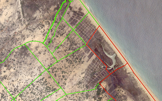
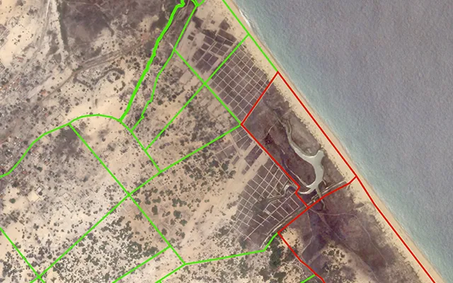
3 October, 2014 I Nagarkovil, Sri Lanka I SkySat-1.  Copyright: Skybox Imaging. Image released as part of Skybox for Good program.

3 October, 2014 I Nagarkovil, Sri Lanka I SkySat-1.
Copyright: Skybox Imaging. Image released as part of Skybox for Good program.

In spite of the advances in Satellite technology and Imaging capabilities, the main road block for using Satellite Imagery for both research and public use as been the lack of open datasets and it is heartening to see that already several organizations including WRI, SkyTruth, Google Ebola Response have requested Skybox for Satellite Imagery.

Skybox and Google however, have not mentioned that the Satellite Imagery will be available in Real-time as reported by some websites. You can check out the images that are already available, here’s the link to the map where this information has been visualized.

This is great news for NGOs! Hopefully, this will enable them to focus on their objectives and not worry about getting Satellite data to derive information.

You can follow @earthoutreach for updates as Skybox Imaging expands the SkyBox for Good program.

Say thanks for this article (0)
The community is supported by:
Become a sponsor
#Business
#Business #Ideas
Urban Digital Twins in China: A Smart Gadget or a Decision Support Tool?
Nianhua Liu 03.28.2024
AWESOME 4
#Business #Environment #Ideas #Satellites
China’s Smart Agriculture Boom Has Tech Potential but Requires Affordable Solutions
Nianhua Liu 05.9.2024
AWESOME 3
#Business #Featured
Call for nominations: Global Top 100 Geospatial Companies 2025 Edition
Avatar for Muthukumar Kumar
Muthukumar Kumar 10.1.2024
AWESOME 1
Next article
#Business #Featured

HERE app unleashed to all Android users after leaking the source files

hand_android

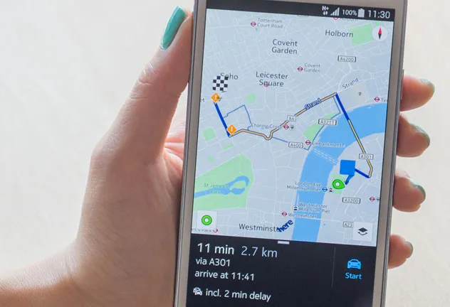
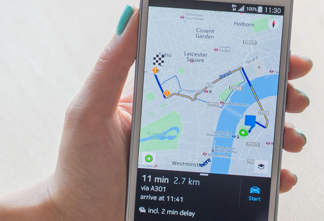
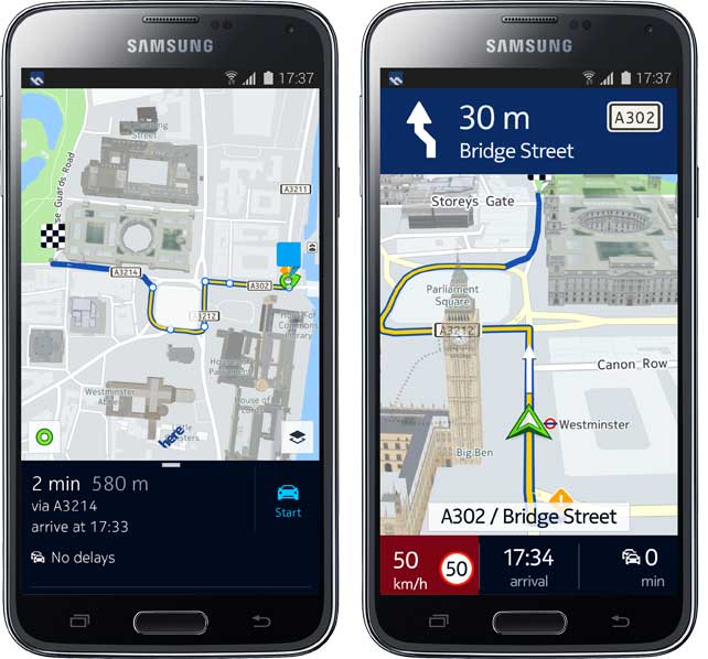
HERE, the mapping brand of Nokia is launching their navigation app to all Android users. The app has been already available for a few weeks to Samsung Galaxy devices owners through the Samsung app store, but according to HERE’s blog post you will be able to install the app on all supported Android smartphones.

LEAKED FILES

Three weeks ago Android Police reported that Nokia leaked the beta files of the app. Is it a coincidence that HERE has made the files available to everybody just few weeks after big announcement of a partnership with Samsung? One could imagine that Samsung paid HERE for licenses for the app. With freely available app HERE might only gain probe data for traffic services and brand recognition of users outside Windows Phone OS… The new app for all Android users is however not available through the Google Play app store. One must download the installation file (APK) from HERE’s website and install it manually using developer mode one your Android phone. It is a bit more complex to execute for mainstream mobile users but it only proves our suspicions why Nokia decided to made it open for everybody.

THE APP ITSELF

The app itself is a much better attempt to win mobile market than HERE’s terrible iOS app which has been finally removed from the iPhone AppStore. I still keep it on my iPhone just to remember how not to make mapping apps. This time the app is really cool. Nice design, cool features.

Geoawesomeness - HERE android

BETTER THAN GOOGLE MAPS? NO BUT STILL IT’S A MUST HAVE!!!

Some people say that it’s better for navigation than Google Maps, as the app which has been designed solely for that purpose. Personally I don’t agree with that opinion. Google Maps is the best free navigation out there with the most accurate real-time traffic information which is actually used really well in the app (which is not common even in paid software). But HERE has one major advantage which makes it must have app on your Android phone. It allows you to download whole countries for the offline mode, which is truly a deal breaker for a well designed and free navigation app.

Read on
Search