

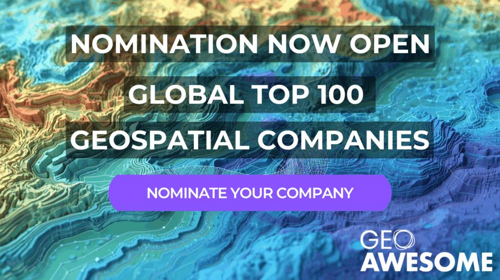
The world’s most recognized geospatial industry list — now powered by the community.
For geospatial companies, innovators, and professionals who are advancing the future of location intelligence, mapping, Earth observation, and geography, the Geoawesome Global Top 100 offers the industry’s most visible platform for recognition, credibility, and connection. In 2026, for the first time, the list will be shaped collectively by the global community it represents.
Companies are invited to officially nominate themselves for the community-voting process using this form.

#GlobalTop100Geo
The geospatial sector is growing rapidly with new companies and business models emerging, but its recognition and awareness is scattered. Startups struggle to gain visibility against established firms, and mid-sized companies with innovative solutions often go unnoticed outside their immediate circles. Historically, companies seeking industry recognition have relied on awards, conferences, and marketing, channels that often favor budget or size. Since 2016, the Geoawesome Global Top 100 Geospatial Companies list has addressed this visibility challenge by offering free, merit-based, and expert-curated recognition of excellence.
2026 is set to be a landmark year for Geoawesome, as we celebrate our 15th Anniversary on Monday, April 20, 2026. This year also marks a decade since the inaugural Top 100 Geospatial companies list was published. To honor these milestones, we are introducing a historic, experimental shift in how our industry’s most recognized list is curated: for the 2026 edition, we are formally inviting the entire global community to step in, for the first time, as our collective expert panel.
A Community-Led Global Top 100 Geospatial Companies List
Traditionally, the Geoawesome Top 100 has been curated by panels of international experts representing academia, business, and research. Over the years, our expert panels have set a high standard, producing lists that have shaped the global conversation about innovation in our industry. This change isn’t about replacing that process, it’s about building on it and testing new, more inclusive ways to recognize impact and innovation.
To celebrate our 15th anniversary, we want to mix things up. By inviting you, the users, innovators, and leaders within the geospatial sector, to be the deciding voices, we aim to:
- Create a broader, more representative list that captures the full dynamism of the global geospatial landscape.
- Ensure we are not missing out on disruptive startups or regional powerhouses known best by those actively working with them.
- Make the selection process more accessible and transparent than ever before.
This is a celebration of our entire ecosystem. The 2026 list will be officially unveiled to coincide with our 15th Anniversary celebration on April 20, 2026.
The New #GlobalTop100Geo Timeline
The list compilation process is shifting from its traditional January release to align with our anniversary in April. The community voting period provides us with enough time to make this process more inclusive and accessible.
How to Nominate and Ensure Your Place on the Shortlist
The first step in generating a truly holistic list is building a robust, high-quality shortlist.
- Self-Nomination is Key: Any company that submits an official nomination form before the deadline will automatically be added to the final shortlist that the community votes on.
- Past Winners are Invited: We are automatically inviting all companies that have been part of the Top 100 list in previous years to formally self-nominate themselves to secure their place on the 2026 shortlist.
Focus on Innovation, Not Public Data
The nomination form is designed to gather vital, useful information for the entire sector: core innovations your company is working on and the core problems you are solving. We focus less on easily accessible public information, ensuring the data collected is valuable to the industry.
Call to Action
Don’t wait! If your company is shaping the future of geospatial technology, we urge you to participate and make sure your innovations are recognized by the wider community.
Submit Your Nomination Today:
➡️ [Link to Geoawesome 2026 Nomination Form]
Use the hashtag #GlobalTop100Geo to follow the process and spread the word!
Frequently Asked Questions (FAQs)
Q1. How will the final Top 100 list be decided for the 2026 edition?
The final list will be determined by the community vote. Once the nomination period closes, we will compile the full, comprehensive shortlist. The community will then have two months (Feb 16 – Apr 10) to vote for the companies they believe should be included in the Global Top 100 Geospatial Companies 2026.
Q2. Is the community replacing the expert panel permanently?
No. This is a special, one-time experiment to mark our 15th anniversary. The results of the 2026 community-led process will be carefully reviewed.
Q3. What happens after the 2026 list is published?
Depending on the success of this community process and the lessons we learn, we may:
- Continue with a pure community-led model in future years.
- Develop a hybrid model where the community plays a central role (e.g., in shortlisting or as a voting bloc) and the expert committee provides final oversight.
- Return to the expert-led panel process if that proves more effective for global accreditation.
Our intention is to continuously iterate and improve based on community feedback.
Q4. If I nominate a company, are they guaranteed to be on the final Top 100 list?
No. Nominating a company only guarantees them a spot on the final shortlist that goes before the community for voting. Inclusion in the final Top 100 list depends on receiving enough votes from the community between February 16 and April 10, 2026.
Q5. Can companies nominate themselves?
Yes. Self-nomination is highly encouraged, as it is the easiest way to ensure your company makes it onto the community voting shortlist.
Q6. Will the final list be ranked?
As in previous years, the Geoawesome Global Top 100 Geospatial Companies 2026 will not be a ranked list. Companies will be presented alphabetically to recognize all 100 leading companies equally without implying a specific hierarchy.
The number of votes each company received will also not be disclosed.
Q7. Who can vote in the community selection process?
Any member of the global geospatial community—including professionals, academics, students, company representatives, and enthusiasts—is eligible to vote. There are no restrictions based on geography or organizational affiliation, making voting truly open and inclusive.
Q8. Is there a limit on how many companies I can vote for?
During the voting period, You will have to vote for a minimum of 10 organisations for your vote to be valid. You may vote for a maximum of 100 companies that you feel deserve recognition in the Top 100. However, you cannot vote multiple times for the same company.
We encourage you to vote for all the companies you genuinely believe deserve recognition for their innovation and impact.
Q9. Will others know for whom I voted?
No, we will not reveal any information regarding your votes to anyone else.
Q10. How will you prevent fraudulent or biased voting (e.g., from a single company getting all their employees to vote)?
To ensure the integrity and fairness of the process, we will implement several measures, including:
- Requiring voters to use a verified professional or academic email address;
- Ensuring that only voters who voted for at least 10 organisations are counted; and
- Utilizing data analytics to flag and discount statistically improbable voting patterns.
Our goal is to measure the sentiment of the wider industry, not just a single organization.
Q11. What is required for a valid company nomination?
A valid nomination must answer all mandatory questions in the nomination form including the company’s name, a brief description of core innovations or unique contributions, key problems being solved, and essential contact information.
Q12. Which types of companies are eligible for nomination and voting?
Any company (private or public) that is primarily focused on geospatial technology, data, services, or solutions is eligible. This includes core GIS platforms, remote sensing companies, location intelligence providers, hardware manufacturers, and significant data providers. Startups, SMEs, and large enterprises from any country are all encouraged to participate.
This excludes all government agencies, intergovernmental agencies, universities and research institutions. If you have a specific clarification, please reach out to us <contact information at the end of the post>
Q13: Can companies outside of the previous Top 100 list be nominated?
Absolutely. While past winners and nominees are automatically invited to self-nominate to secure their shortlist spot, the nomination process is designed to discover and recognize the new and emerging innovators in the industry. We encourage nominations for any company you believe is shaping the future of geospatial.
Q14. How will nomination data be used and protected?
Submitted data will be used for the purpose of compiling the shortlist and presenting company profiles to the community and expert committee for voting. All data will be handled securely and in line with Geoawesome’s privacy policy.
Q15. What if my company is not selected for the Top 100?
All nominees will benefit from increased visibility during the voting process and in ancillary coverage. Companies not selected for the Top 100 may receive feedback and can participate in future nomination cycles. In addition, we will include all nominated companies in our 2026 Geospatial Industry Report.
Q16. Can companies campaign or promote themselves during voting?
Yes. Nominees are encouraged to share their innovations and accomplishments on social media, using the hashtag #GlobalTop100Geo, and engage the community to support their candidacy.
In case you have any further questions about the process, please contact muthu@geoawesome.com
#GlobalTop100Geo 2025 Edition


#Featured


Next article
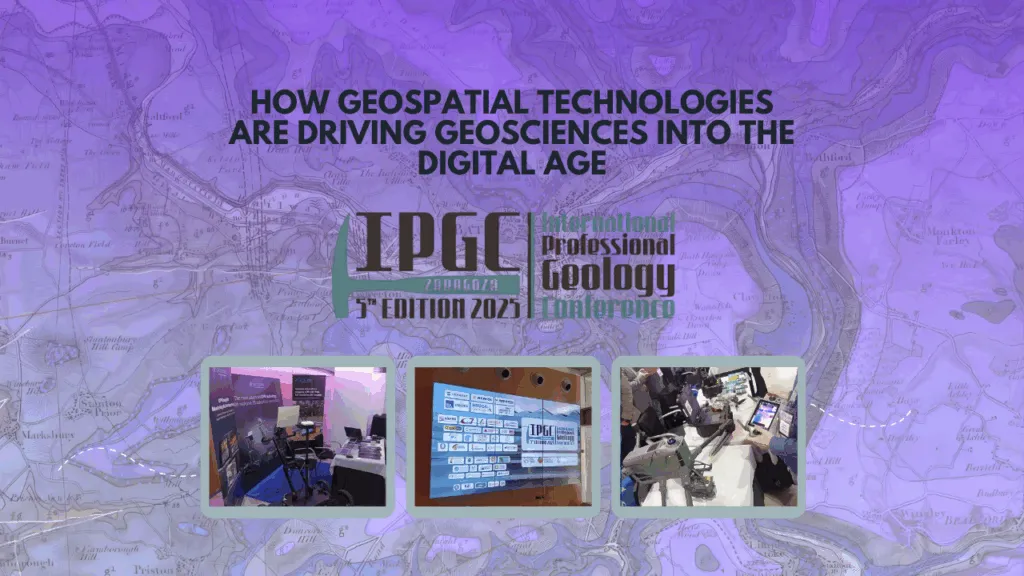
Reflection on the 5th IPGC: How Geospatial Technologies Are Driving Geosciences into the Digital Age

The 5th International Professional Geosciences Conference (IPGC) made one thing clear: the future of geosciences is digital. Across presentations and posters, it became evident that geospatial tools, remote sensing, and Earth observation are no longer just supportive, but they are redefining how geoscientists collect data, model the subsurface, and manage Earth’s resources.
1. Transforming Data Acquisition: Earth Observation and Remote Sensing
UAVs and Photogrammetry in Action
Drone-based photogrammetry has become a cornerstone for modern geological surveys. Case studies, from landslide inspections in Hong Kong to structural mapping in rugged terrain, show how UAVs deliver fast, safe, and high-resolution data collection that was once time-consuming and risky.
Enhanced Landslide Inspections with Consumer UAV & Photogrammetry
Monitoring Environmental Change
EO technologies are proving indispensable for tracking land surface dynamics, especially in post-industrial landscapes. The study from southern Poland demonstrated how integrated remote sensing helps monitor ground instability in areas with critical raw materials, offering valuable insights for sustainable resource management.
2. The Digital Subsurface: 3D Modeling and Smart Geoscience Systems
The conference’s “Geology 4.0” session captured a key shift: from static maps to interactive 3D and even 4D geological models, supported by AI and high-performance computing.
High-Performance Geological Modeling
Researchers showcased new ways to build detailed geological models using QGIS and advanced computing architectures such as CUDA and GPUs. These tools allow scientists to handle complex terrain modeling and multi-variable simulations with speed and precision.
Read more: https://gitlab.com/brgm/geomodelling/forgeo
Specialized Software for Complex Geology
Hands-on workshops using Leapfrog Geo and Leapfrog Works by SEEQUENT highlighted structural modeling techniques for geology, alteration, and contamination (GAC). Such tools are becoming standard for understanding environmental and mining contexts in 3D.
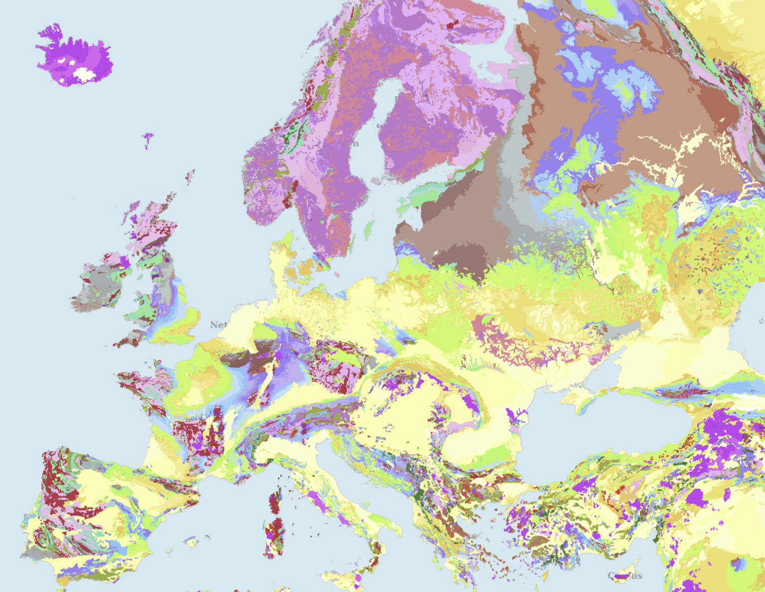
Building Europe’s Digital Geoscience Backbone
Data infrastructure is the foundation of the digital transition. The IGME-CSIC presented its work on Geoscience Information Systems; turning vast datasets into actionable insights. European initiatives: GSEU Project and the European Geological Data Infrastructure (EGDI) are key to creating a shared digital framework for geological information across the continent.
3. Geophysical and Geochemical Frontiers
Modern geoscience is about detecting what lies beneath; and geophysical and geochemical tools are pushing those boundaries.
Geophysical Characterization for Water and Energy
Techniques like Electrical Resistivity Tomography (ERT) are helping delineate saline wetlands and groundwater systems, while gravimetric surveys in areas such as Las Navas–Cañaveral and the Ebro Basin are refining our understanding of CO₂ storage potential.
Integration of New Technologies to Improve Groundwater Knowledge
Data-Driven Geochemistry
The combination of XRF core scanning and multisensor analysis is turning drill cores into digital datasets. Platforms such as BOXSCAN at CN IGME-CSIC are making it possible to map element distributions in Li-rich pegmatites, while machine learning segmentation is transforming how core-scan data are interpreted, speeding up geological logging and discovery.
4. The Intelligence Revolution: AI and Digital Geology
Artificial Intelligence is now an active collaborator in geoscientific research.
AI in Water and Environmental Studies
Machine learning models are being applied to analyze groundwater resources, assess contamination risks, and optimize environmental management strategies.
Large Language Models in Geoscience
Workshops on GeoGPT–Deep-Time Digital Earth showed how large language models (LLMs) can help geoscientists search, summarize, and connect complex datasets. From fossil identification to automated literature reviews, these tools are opening new paths for knowledge discovery and research collaboration.
Conclusion
The message from the 5th IPGC is clear: digital transformation is redefining geoscience. The ability to integrate UAVs, EO data, advanced modeling, and AI systems is becoming essential for tackling global challenges and shaping how we understand and protect our planet.
Acknowledgments
The success of the IPGC reflects the vision and dedication of its organizers, including the Spanish Official Professional Association of Geologists (ICOG), led by Nieves Sánchez, President of both ICOG and IPGC 2025.
Official website of the 5th IPGC
https://www.5th-ipgc.com/posters/
Did you like this post? Read more and subscribe to our monthly newsletter!
#GlobalTop100Geo
The geospatial sector is growing rapidly with new companies and business models emerging, but its recognition and awareness is scattered. Startups struggle to gain visibility against established firms, and mid-sized companies with innovative solutions often go unnoticed outside their immediate circles. Historically, companies seeking industry recognition have relied on awards, conferences, and marketing, channels that often favor budget or size. Since 2016, the Geoawesome Global Top 100 Geospatial Companies list has addressed this visibility challenge by offering free, merit-based, and expert-curated recognition of excellence.
2026 is set to be a landmark year for Geoawesome, as we celebrate our 15th Anniversary on Monday, April 20, 2026. This year also marks a decade since the inaugural Top 100 Geospatial companies list was published. To honor these milestones, we are introducing a historic, experimental shift in how our industry’s most recognized list is curated: for the 2026 edition, we are formally inviting the entire global community to step in, for the first time, as our collective expert panel.
A Community-Led Global Top 100 Geospatial Companies List
Traditionally, the Geoawesome Top 100 has been curated by panels of international experts representing academia, business, and research. Over the years, our expert panels have set a high standard, producing lists that have shaped the global conversation about innovation in our industry. This change isn’t about replacing that process, it’s about building on it and testing new, more inclusive ways to recognize impact and innovation.
To celebrate our 15th anniversary, we want to mix things up. By inviting you, the users, innovators, and leaders within the geospatial sector, to be the deciding voices, we aim to:
- Create a broader, more representative list that captures the full dynamism of the global geospatial landscape.
- Ensure we are not missing out on disruptive startups or regional powerhouses known best by those actively working with them.
- Make the selection process more accessible and transparent than ever before.
This is a celebration of our entire ecosystem. The 2026 list will be officially unveiled to coincide with our 15th Anniversary celebration on April 20, 2026.
The New #GlobalTop100Geo Timeline
The list compilation process is shifting from its traditional January release to align with our anniversary in April. The community voting period provides us with enough time to make this process more inclusive and accessible.
How to Nominate and Ensure Your Place on the Shortlist
The first step in generating a truly holistic list is building a robust, high-quality shortlist.
- Self-Nomination is Key: Any company that submits an official nomination form before the deadline will automatically be added to the final shortlist that the community votes on.
- Past Winners are Invited: We are automatically inviting all companies that have been part of the Top 100 list in previous years to formally self-nominate themselves to secure their place on the 2026 shortlist.
Focus on Innovation, Not Public Data
The nomination form is designed to gather vital, useful information for the entire sector: core innovations your company is working on and the core problems you are solving. We focus less on easily accessible public information, ensuring the data collected is valuable to the industry.
Call to Action
Don’t wait! If your company is shaping the future of geospatial technology, we urge you to participate and make sure your innovations are recognized by the wider community.
Submit Your Nomination Today:
➡️ [Link to Geoawesome 2026 Nomination Form]
Use the hashtag #GlobalTop100Geo to follow the process and spread the word!
Frequently Asked Questions (FAQs)
Q1. How will the final Top 100 list be decided for the 2026 edition?
The final list will be determined by the community vote. Once the nomination period closes, we will compile the full, comprehensive shortlist. The community will then have two months (Feb 16 – Apr 10) to vote for the companies they believe should be included in the Global Top 100 Geospatial Companies 2026.
Q2. Is the community replacing the expert panel permanently?
No. This is a special, one-time experiment to mark our 15th anniversary. The results of the 2026 community-led process will be carefully reviewed.
Q3. What happens after the 2026 list is published?
Depending on the success of this community process and the lessons we learn, we may:
- Continue with a pure community-led model in future years.
- Develop a hybrid model where the community plays a central role (e.g., in shortlisting or as a voting bloc) and the expert committee provides final oversight.
- Return to the expert-led panel process if that proves more effective for global accreditation.
Our intention is to continuously iterate and improve based on community feedback.
Q4. If I nominate a company, are they guaranteed to be on the final Top 100 list?
No. Nominating a company only guarantees them a spot on the final shortlist that goes before the community for voting. Inclusion in the final Top 100 list depends on receiving enough votes from the community between February 16 and April 10, 2026.
Q5. Can companies nominate themselves?
Yes. Self-nomination is highly encouraged, as it is the easiest way to ensure your company makes it onto the community voting shortlist.
Q6. Will the final list be ranked?
As in previous years, the Geoawesome Global Top 100 Geospatial Companies 2026 will not be a ranked list. Companies will be presented alphabetically to recognize all 100 leading companies equally without implying a specific hierarchy.
The number of votes each company received will also not be disclosed.
Q7. Who can vote in the community selection process?
Any member of the global geospatial community—including professionals, academics, students, company representatives, and enthusiasts—is eligible to vote. There are no restrictions based on geography or organizational affiliation, making voting truly open and inclusive.
Q8. Is there a limit on how many companies I can vote for?
During the voting period, You will have to vote for a minimum of 10 organisations for your vote to be valid. You may vote for a maximum of 100 companies that you feel deserve recognition in the Top 100. However, you cannot vote multiple times for the same company.
We encourage you to vote for all the companies you genuinely believe deserve recognition for their innovation and impact.
Q9. Will others know for whom I voted?
No, we will not reveal any information regarding your votes to anyone else.
Q10. How will you prevent fraudulent or biased voting (e.g., from a single company getting all their employees to vote)?
To ensure the integrity and fairness of the process, we will implement several measures, including:
- Requiring voters to use a verified professional or academic email address;
- Ensuring that only voters who voted for at least 10 organisations are counted; and
- Utilizing data analytics to flag and discount statistically improbable voting patterns.
Our goal is to measure the sentiment of the wider industry, not just a single organization.
Q11. What is required for a valid company nomination?
A valid nomination must answer all mandatory questions in the nomination form including the company’s name, a brief description of core innovations or unique contributions, key problems being solved, and essential contact information.
Q12. Which types of companies are eligible for nomination and voting?
Any company (private or public) that is primarily focused on geospatial technology, data, services, or solutions is eligible. This includes core GIS platforms, remote sensing companies, location intelligence providers, hardware manufacturers, and significant data providers. Startups, SMEs, and large enterprises from any country are all encouraged to participate.
This excludes all government agencies, intergovernmental agencies, universities and research institutions. If you have a specific clarification, please reach out to us <contact information at the end of the post>
Q13: Can companies outside of the previous Top 100 list be nominated?
Absolutely. While past winners and nominees are automatically invited to self-nominate to secure their shortlist spot, the nomination process is designed to discover and recognize the new and emerging innovators in the industry. We encourage nominations for any company you believe is shaping the future of geospatial.
Q14. How will nomination data be used and protected?
Submitted data will be used for the purpose of compiling the shortlist and presenting company profiles to the community and expert committee for voting. All data will be handled securely and in line with Geoawesome’s privacy policy.
Q15. What if my company is not selected for the Top 100?
All nominees will benefit from increased visibility during the voting process and in ancillary coverage. Companies not selected for the Top 100 may receive feedback and can participate in future nomination cycles. In addition, we will include all nominated companies in our 2026 Geospatial Industry Report.
Q16. Can companies campaign or promote themselves during voting?
Yes. Nominees are encouraged to share their innovations and accomplishments on social media, using the hashtag #GlobalTop100Geo, and engage the community to support their candidacy.
In case you have any further questions about the process, please contact muthu@geoawesome.com
#GlobalTop100Geo 2025 Edition

