
Spring is the time when nature is reborn after winter. On social media we can notice plenty of images of blooming trees and flowers in parks and meadows. Is there any scientific explanation for a flood of photos on social media? Well, there is. Did you know that in May and June in Europe, we can notice the highest NDVI index rate? The main cause of this phenomenon is the fact that a balanced amount of rainfall and optimal temperature enhance plant growth and vegetation.
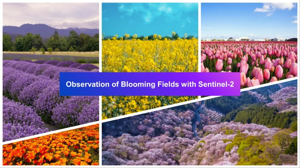
The term “blooming earth” generally refers to the seasonal blooming of flowers, plants, and vegetation across different regions of the planet. It captures the vibrant and colorful displays of blooming that occur during spring and other times of the year.
People love flowers, making the whole world more colorful. Seeing flower fields from the ground is common, but have you ever wondered what blooming meadows look like from space?
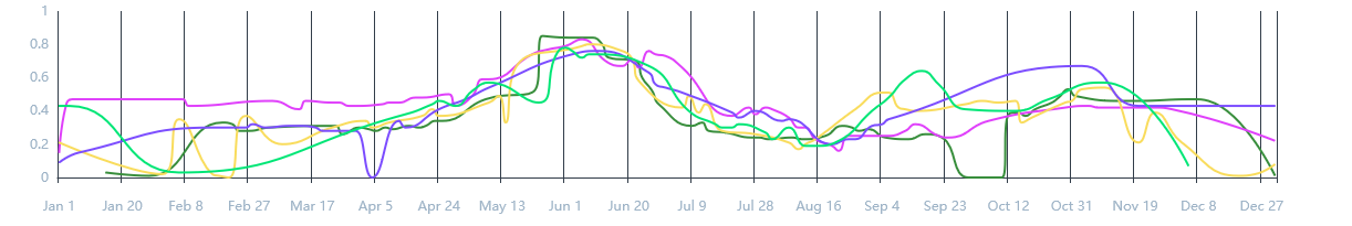
Example of the distribution of the NDVI index over the years 2019-2023. Source: crop-monitoring.eos.com
Observing Earth with satellite imagery
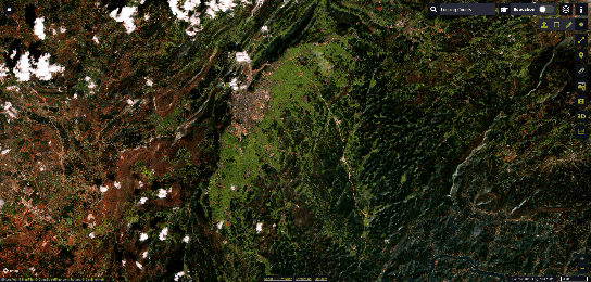
The blooming of vegetation, especially large-scale events like wildflower “super blooms” or agricultural crop blooms, can be detected and observed from space using satellite imagery. Satellites such as Sentinel-2, the optical satellite, can capture the distinct spectral signatures and changing colors associated with blooming events across our planet. Sentinel-2 allows to monitor the Earth’s surface with a resolution of up to 10 meters. The main problem in finding an appropriate image is the cloud coverage. This satellite is not able to penetrate the clouds. So, imagery of flowering fields using the example of the UK border with a miracle. The second issue is finding imagery from an exact period of time. For instance, the super blooming phenomenon, which occurs in the USA, can literally last a few days. Sentinel-2 satellite may simply not have time to take the photo of suitable terrain.
SentinelHub is a great solution for finding satellite imagery from Sentinel, Landsat or MODIS. It allows you to make selections in the defined ROI and time range – even from a dozen years ago. Moreover, it’s a powerful tool to play with spectral bands and visualize the data.
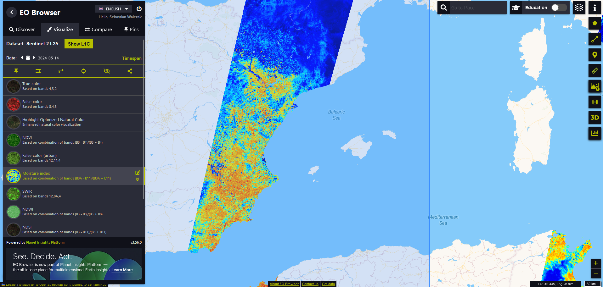
SentinelHub – overview
Blooming Earth in Sentinel-2 images
1. Lavender fields
Sentinel-2 imagery of the lavender fields in Valensole, France, during the period of June to July, captures the vibrant, blooming lavender in full splendor. These images not only provide visual beauty but also offer insights into agricultural practices and bloom intensity, which can be crucial for local farmers and tourism stakeholders. The satellite photos from this specific timeframe help in monitoring the health of the crops and planning the peak times for tourists to visit and experience the picturesque scenery.
2020-06-23 – 2020-07-08, Valensole, France
2. Rapeseed fields
Satellite imagery from February 26 to March 12, 2020, of the rapeseed fields in Luoping County, China, showcases the expansive golden-yellow fields that are characteristic of rapeseed bloom. These images serve as a valuable tool for assessing the extent and health of the crops, aiding agricultural planning and management. Additionally, the vibrant floral expanses captured from above attract photographers and tourists, boosting local tourism during the blooming season.
2020-02-26 – 2020-03-12, Luoping County, China
Satellite imagery from May 9, 2024, capturing the rapeseed fields at the mouth of the Vistula River in Poland, highlights the striking contrast of bright yellow blooms against the surrounding landscape. Sentinel-2 imagery may be crucial for agricultural monitoring, providing data on crop health and growth progress, which assists farmers in optimizing their yields. Additionally, the vivid colors and patterns visible from space and ground also draw attention to the natural beauty of the area, promoting it as a picturesque destination for both domestic and international tourists. This example shows how satellite imagery can provide up-to-date data.
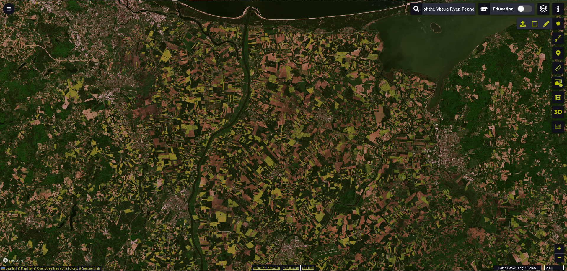
2024-05-09, The mouth of the Vistula River, Poland
3. Tulip fields
Keukenhof, Netherlands is well known for tulip fields. The images below present the transformation as vivid stripes of red, yellow, pink, and orange tulips come into bloom, creating a stunning visual mosaic. The time around 20 of April each year was the best day to see this mosaic of colors.
Time series: 2018-04-21, 2019-04-21, 2020-04-20, 2022-04-20 and 2023-04-30, Keukenhof, Netherlands
4. Blossom trees
Comparison between two satellite images shows the peak blooming period and the period after blooming in Mount Yoshinoyama Blossom Gardens, Japan. These images reveal a view of pink hues blanketing the landscape, offering a perspective on the spatial distribution and density of the blossoms. Time series comparison is often crucial for ecological and agricultural monitoring.
Mount Yoshinoyama Blossom Gardens, April-May 2022
Satellite imagery from March 15, 2018, showcases the blossom gardens in Pingba, Guizhou, China, where the early spring bloom paints the landscape in varied shades of pink. The visual documentation from satellites enhances the appreciation of these gardens’ aesthetic and ecological value, attracting attention from both researchers and tourists.
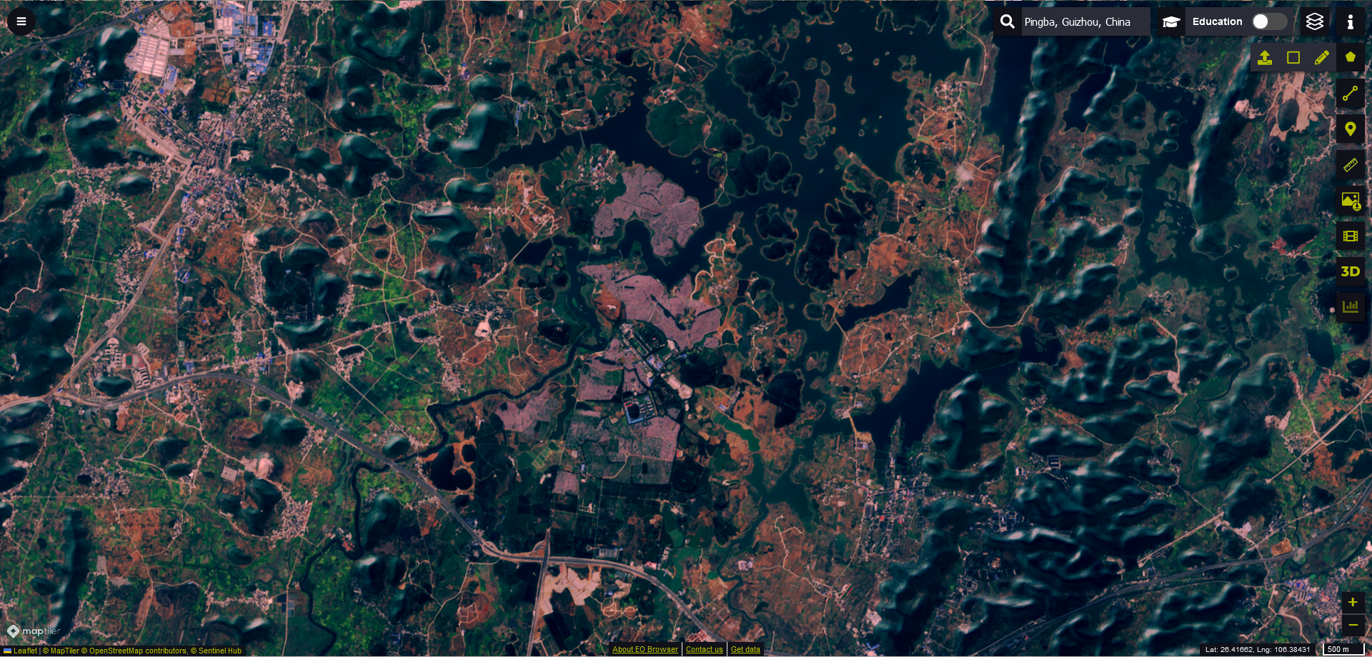
2018-03-15, Pingba, Guizhou, China
5. Super Blooming in USA
This image from April 14, 2019, captures the extraordinary super bloom in Antelope Valley, USA, where the desert landscape was transformed by an extensive and vibrant display of wildflowers. The vivid colors, dominated by orange and yellow, highlight the intensity and spread of this natural event. These images are not only spectacular visually but also serve as critical tools for ecological research, documenting the effects of climatic variations on desert flora.
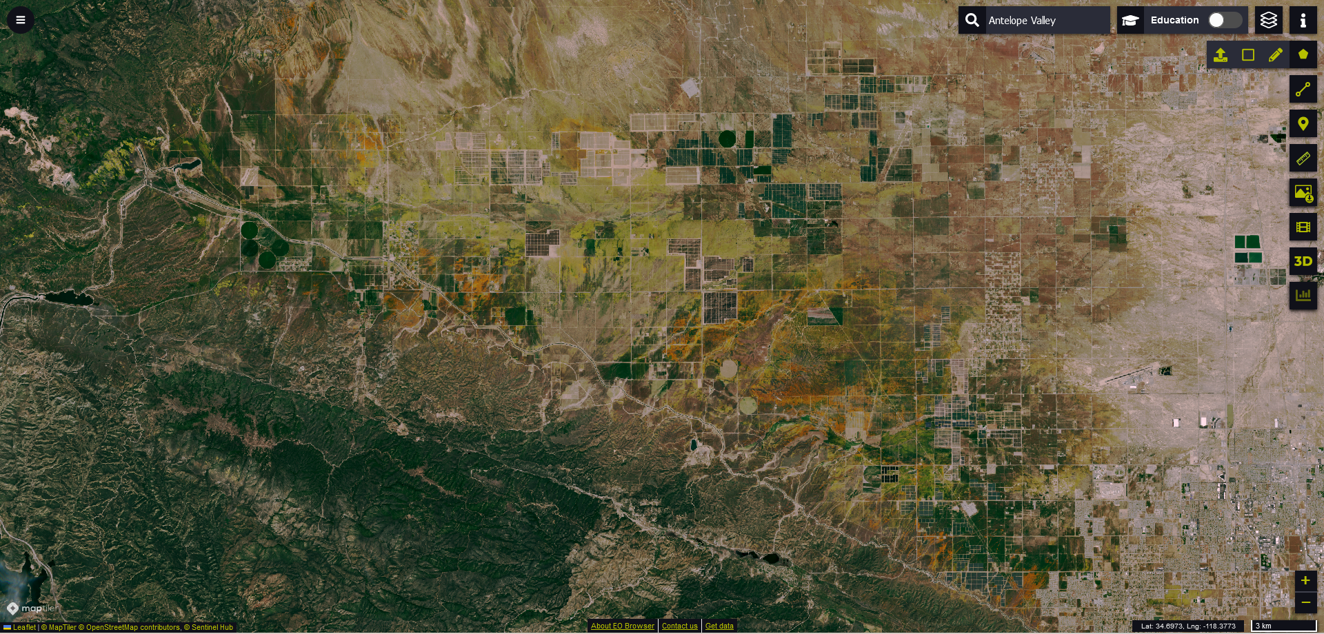
2019-04-14, Antelope Valley, USA
Another visualization from April 7, 2019, reveals the stunning super bloom at Carrizo Plain National Monument, USA, showcasing vast expanses with wildflowers. The visual spectacle of yellows and purples, visible from space, underscores the ecological richness and diversity of the area during peak blooming season.
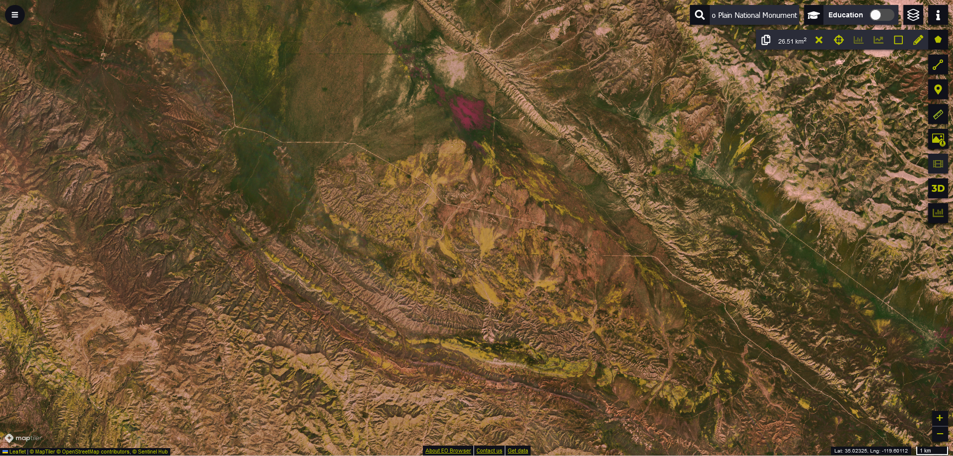
2019-04-07, Carrizo Plain National Monument, USA
In summary
The examples above effectively illustrate the utility of Sentinel-2 satellite imagery in capturing the Earth’s phenological events, such as the vibrant blooms across various global locations. By providing high-resolution images of phenomena like the super blooms in the USA and the seasonal blossoms in the Keukenhof, Netherlands, Sentinel-2 aids in both ecological monitoring and enhancing tourism through its detailed visual records.
Additionally, the discussion about SentinelHub as a platform underscores the importance of accessible satellite imagery for scientific research, agricultural planning, and environmental conservation, highlighting the intersection of technology and nature observation. Apart from the usefulness of satellite imagery, these photos are simply beautiful!
Did you like this post? Read more and subscribe to our monthly newsletter!


#Fun


Next article


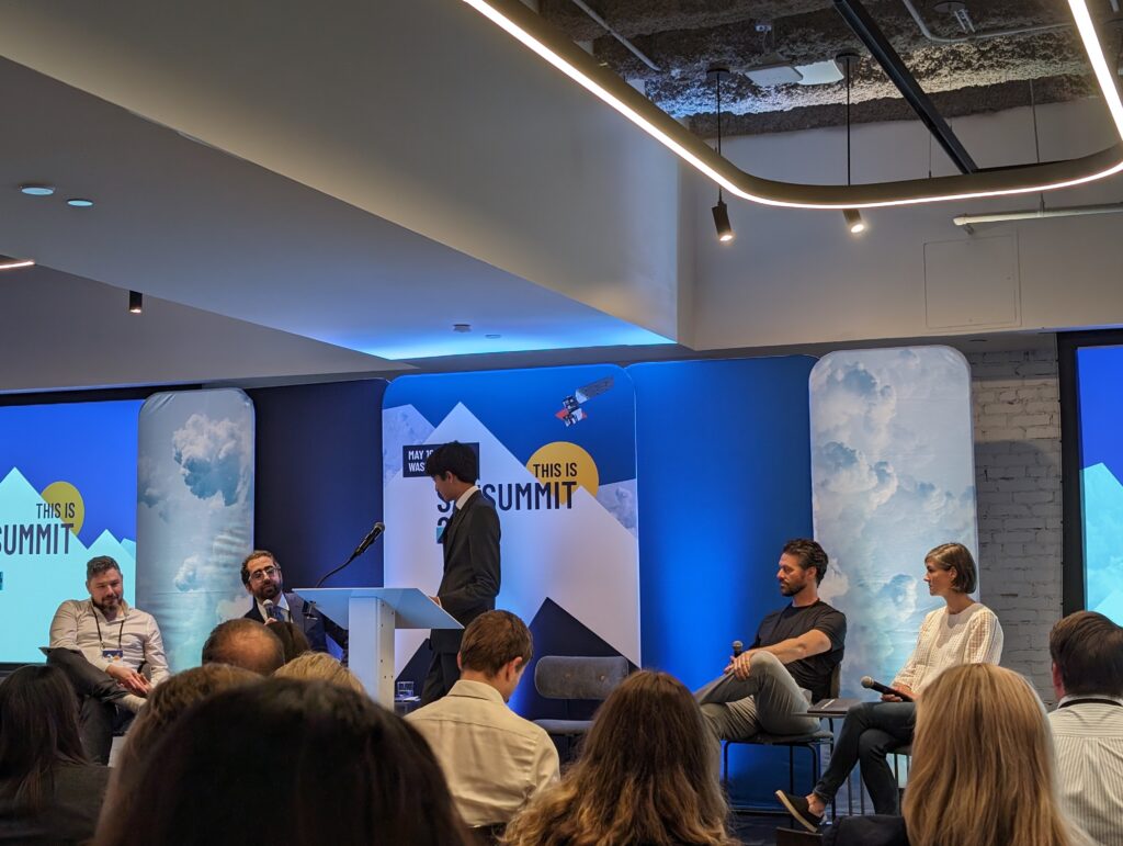
The latest SatSummit 2024 in Washington, D.C., convened experts, leaders, and stakeholders to delve into presentations and conversations around the evolving landscape of Earth Observation. The event underscored significant shifts in data accessibility and the imperative role of artificial intelligence in addressing climate and societal challenges.
Satellite State of Play and the Dawn of Earth AI
As we navigate through an era marked by an explosion in private satellite ventures and applications, the summit highlighted a collective endeavor to demystify the EO bubble. The narrative has shifted from launching satellites with deferred utility contemplation to a strategy rooted in addressing pre-existing market and user needs.
The propulsion of Earth AI into the spotlight marked a definitive trend. Foundation Models and Large Vision Models are redefining the paradigms of transfer learning and model-centric approaches, steering the community towards a data-centric perspective. These advancements are not just technological leaps but are pivotal in making EO data more actionable and accessible.
Application Frontiers and the Quest for Impact
The differences between supply-side and demand-side drivers in EO applications presented a multifaceted view of the sector’s trajectory. While space agencies and philanthropic endeavors fuel the supply side, the demand side grapples with translating EO investments into tangible impacts, emphasizing the necessity of making data not just available but genuinely actionable.
Amidst this, the summit put forth an urgent call to harness EO data for crafting effective environmental intelligence products. The discourse transcended the bounds of conventional applications, advocating for a synergy between technological advancements and the profound needs of decision-making bodies.
Bridging Gaps and Pioneering New Frontiers
An intriguing dialogue among satellite providers and implementers unraveled the criticality of timely EO data across a spectrum of emergencies. However, an undercurrent of concern was palpable regarding the EO SPACs’ depreciating value, posing intricate challenges and opportunities for the sector.
As foundational models emerge as the cornerstone of EO advancements, workshops dedicated to these technological marvels offered hands-on experiences aimed at harnessing their potential for sustainable and developmental applications. Such interactions exemplified a concerted effort to transition these breakthroughs from theoretical confines to real-world impact.
Looking Ahead: Synthesis and Synergies
The summit envisaged a future where EO stands at the forefront of combating climate change, enhancing sustainability, and informing policy and humanitarian efforts. From fostering open access data to advocating for cloud-native approaches, the discussions underscored the pivotal role of collaboration, innovation, and commitment to public benefit.
As we pivot towards new horizons, the inauguration of a European SatSummit in Lisbon later this year signifies a burgeoning global dialogue and a united front in the EO community. The myriad of sessions, workshops, and discussions at the summit not only showcased the current state of EO but also charted a course for its hopefully impactful future.
In closing, SatSummit underscored a collective vision for EO – one that transcends surveillance and data collection to become a bedrock for informed decision-making, resilient societies, and a sustainable planet.
Did you like this post about SatSummit? Read more and subscribe to our monthly newsletter!

