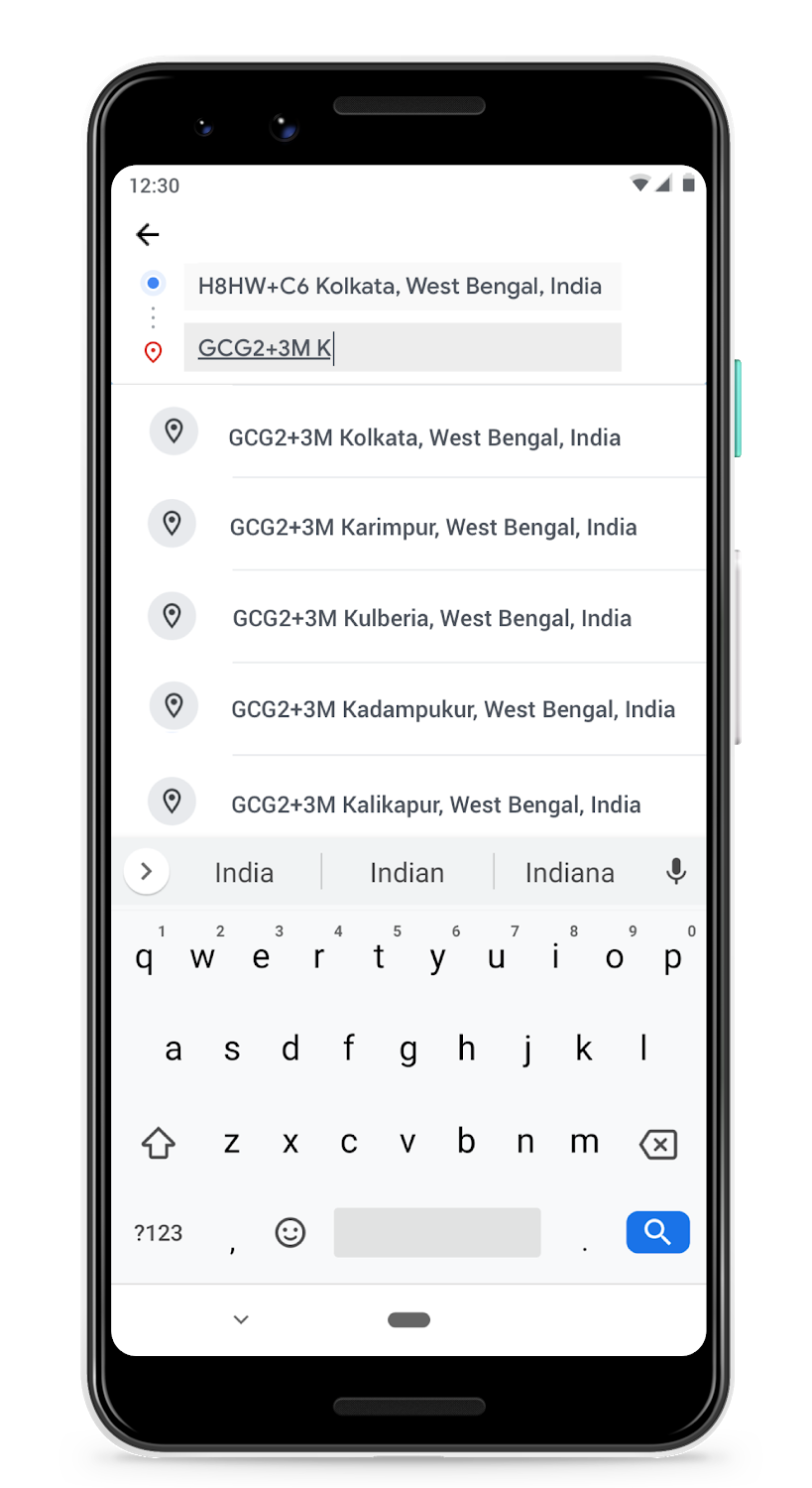
 Google has integrated its digital addressing system Plus Codes into Place Autocomplete across Places API, Places Library in Maps JavaScript API, and Places SDK for Android. This means anytime the first letter of the town or locality in a Plus Code address is typed into a location-based service app, the application will automatically start returning Plus Code suggestions. Places SDK for iOS will also receive the integration soon.
What are Plus Codes and why do we need them?
You and I may not realize the importance of having a precise, searchable address. But there are countless others who are struggling to access critical services like mail, deliveries, voter registration, and emergency services on a daily basis.
According to the World Bank, half of the world’s urban population lives on an unnamed street. This is why, for more than half a decade now, a group of engineers at Google have been working to provide digital addresses for places that lack a traditional addressing system.
A Plus Code is an address based on the latitude and longitude coordinates of a location. Each code is 10 characters long and consists of two parts:
- The first four characters are the area code, indicating a region of roughly 100 x 100 kilometers
- The last six characters are the local code, identifying the neighborhood and the building, measuring roughly 14 x 14 meters (or about half the size of a basketball court)
The code can also be combined with a locality. For example, Google’s HQ can be described as either “849VCWC8+R9” or “CWC8+R9 Mountain View”.
Benefits of Plus Codes
The biggest advantage of Plus Codes is that unlike other alternate addressing systems, they are open-source and free-to-use. There are no licensing fees or other costs. Also, since Plus Codes do not use country codes, they work in places that haven’t been mapped. Similarly, they can be used in disputed territories also. And they work just the same if you are accessing Maps in offline mode.
Arguably, it could take some effort to memorize a Plus Code but it may help to remember that places that are close to each other have similar plus codes. This makes it easy to work out if you are near to, or far away from your destination. You can always print out the Code as a grid on paper, posters, or signs!
The following video will help you understand how Plus Codes are being used to provide addresses to residents of underserved urban communities in Kolkata, India:
Now that Plus Codes have been integrated into Places library, end-users will be able to indicate their precise locations to businesses and receive crucial goods and services that were difficult to access before. And businesses can better serve existing regions or expand their operations to new regions they couldn’t serve before.


