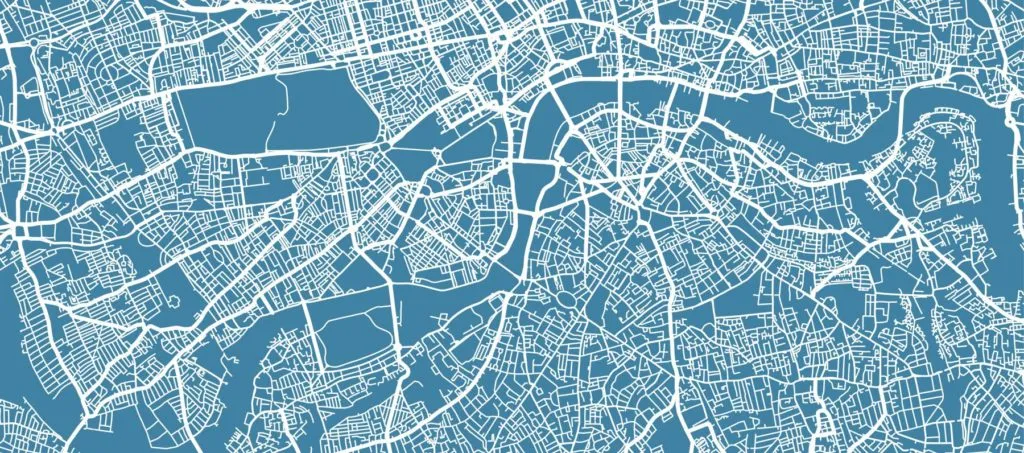
“Geospatial tells the story of the delivery driver taking an optimized route. Geospatial tells the story of the construction worker putting in the groundwork to create a livable community. Geospatial tells the story of everyday people, where they shop, and what they like to buy. If we let it, geospatial tells the story of the human experience – what makes us tick and what drives us forward.”
To Begin – A Story
Have you ever felt the need for more, for something genuine, like something is missing and there is a disconnect? In our highly connected world of electronics fueled by the Internet, I often feel disconnected from something deeply human. It’s hard to put a finger on it, but I will phrase it colloquially as the “human experience”.
To illustrate, I’d like to share a short story about an experience I had in New Orleans. I was on vacation, walking the streets with my partner, enjoying the sights, sounds, smells, and noise of a culture uniquely it’s own. I had just purchased a sketch of Lafitte’s Blacksmith Shop from a local artist. It is one of the oldest structures in New Orleans, now turned into a bar on the far end of Bourbon St. Rumors circulate that, in the times of yore, strategic meetings took place that contributed to America’s acquisition of the Louisiana Purchase.
My partner and I had just arrived and sat outside with our drinks in a quaint spot underneath a rustic gaslit lamp. The bar was crowded. The atmosphere was regal. At this time, a homeless man passed by pushing a wheelchair with a gray pit bull in it, roughly 45 lbs or so. The pit bull was still young. Being dog lovers, my partner and I reached out to pet the dog. The dog was more interested in a water bottle we had than in us. We promptly let the man and dog have our water bottle which turned into one of the most genuine conversations I’ve had in recent memory. The man was a veteran. He was in the Marines and part of a combat mission where the majority of his company passed away, and he was one of the few survivors. A memorial video created by his unit is available by searching “Combat Footage of US Marines in Fallujah, Iraq |Music Video|” on YouTube.
He is around the 2:12 mark in the video. We sat there enchanted as he forwarded to that part of the video, relishing in the memory of his youth. The big nose was unmistakably his. Listening to him describe his story in such vivid detail was a treat. Around us, in my periphery, I saw people giving us judgmental glares while overhearing the occasional potshot about the homeless man’s dog needing water. His dog had water.
The effect was disorienting, like a drunken stupor where the lines between perception and reality blur and become hard to distinguish. It was refreshing and shocking, like the effect felt when standing underneath a waterfall with arms outstretched. I’d take a conversation with this man over those people any day.
Geospatial and the Human Experience

Credited to ThinkPlace – Mapping the Full Picture
What does this story have to do with geospatial? It got me thinking about the things I take for granted every day. The beautiful things I pass by that I no longer seem to notice. The convenient things I consume that help me stay comfortable. The practical things I use that others around the world desperately need.
Geospatial technology helps our packages get delivered quicker, helps us plan and keep track of utilities, and helps us predict behavior before it happens, among other things. At its core, though, geospatial tells a story. Geospatial tells the story of the delivery driver taking an optimized route. Geospatial tells the story of the construction worker putting in the groundwork to create a livable community. Geospatial tells the story of everyday people, where they shop, and what they like to buy. If we let it, geospatial tells the story of the human experience – what makes us tick and what drives us forward.
What are the stories of people living in third world countries? What are the stories of people living under systemic bias? What are the stories of people responding to and providing humanitarian aid during natural disasters? What are the stories of people taking time to slow down, understand, and solve these problems?
Geospatial technology enables us to tell these stories, broaden our perspectives and connect with the world around us. With every initiative put in place to solve a critical issue and every data point plotted to add a spatial component to the issue, we have the opportunity to learn and grow more connected. We are better able to understand, empathize, and cohabitate within the world we all share. What I’d like to do is share a few individuals and organizations that are working towards a brighter world and using geospatial as a means to do so.
Out of Eden Walk
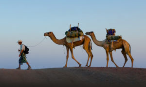
Photograph by John Stanmeyer at National Geographic.
Something that has fascinated me for many years now – Paul Salopek’s experiment in slow journalism, an attempt to walk the 24,000-mile path that humanity took from our origins in Africa to present day. More to the point for me: the tagline of Slow Down, Find Humanity on the front page of National Geographic’s blog.
Paul has been walking the Earth and retracing humanity’s footsteps since 2013. Along the way, he has experienced people, cultures, and landscapes in a way that few of us ever will. The blog is full of maps and photographs partitioning the journey in consumable digestible bits. At the helm of that effort is the geospatial technology that has allowed for a more enriched modern day storytelling experience.
During his Esri 2020 User Conference presentation (link here), Paul describes an experience walking with Afar pastoralists, camel herders who move their animals up and down the Rift Valley of Africa. He describes in vivid detail what he observed and learned from them – an alertness and smooth fluid walk. How often do we slow down and observe people in this way?
Humanitarian Open Street Map
Map credited to Benjamin Herforts at Humanitarian Open Street Map
Another fantastic initiative is Humanitarian OpenStreetMap. Supporting gargantuan efforts such as Water & Sanitation, Disaster Response, and Poverty Elimination, the Humanitarian OpenStreetMap team describes themselves as:
“… an international team dedicated to humanitarian action and community development through open mapping. We work together to provide map data which revolutionizes disaster management, reduces risks, and contributes to achievement of the Sustainable Development Goals.”
Spanning the What We Do page are topics such as “Reaching those in need through maps”, “Putting the world’s most vulnerable people and places on the map”, “Expanding knowledge across partners and communities”, and “Developing innovative new technology to serve the humanitarian and development communities.
Geospatial technology provides visibility to these issues and allows us to support their efforts freely and almost effortlessly.
Los Angeles County Homelessness & Housing Map
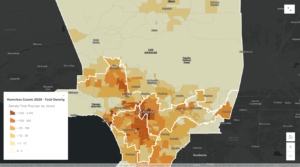
Credited to Los Angeles County Homeless Initiative
Of a more informative nature is the Los Angeles County Homelessness & Housing Map. It provides data and visuals to communicate the story of homelessness in LA and the efforts people are taking to remedy that. Homelessness counts, current and planned interim housing, and winter shelters are all topics that are hit on.
This is a great one to spend a few minutes viewing via the StoryMap presentation accessed by clicking on the photo.
The Message
In the examples above, I shared three examples spanning volunteer, state and local government, and private organizations. To me, this illustrates just how powerful of a tool geospatial technology is to tell stories, educate, and help make the world a better place. In short, geospatial is a great way to connect with the human experience.
Storytelling has been used throughout the span of history to keep events, communities, and cultures alive. The desire to be remembered and not forgotten is an innate part of human nature. In our modern information age, we receive so much stimulation that it is hard to focus and internalize the people and world around us.
The message I’d like to communicate is that is takes a conscious effort to maintain connectedness, but it essential to our nature. I hope you enjoyed the stories and resources in the article. I’d love to hear your thoughts. What do you think about geospatial and the human experience? What resources have you come across that spread a similar message? Disagreements? Thoughtful discourse? Let me know in the comments!

 Osamu has experienced for more than 25 years to develop Earth observation satellite data and information system and possesses scientific and technical expertise in JAXA. He has advocated throughout his career the use of satellite EO data in various stakeholders in Japan and internationally.


