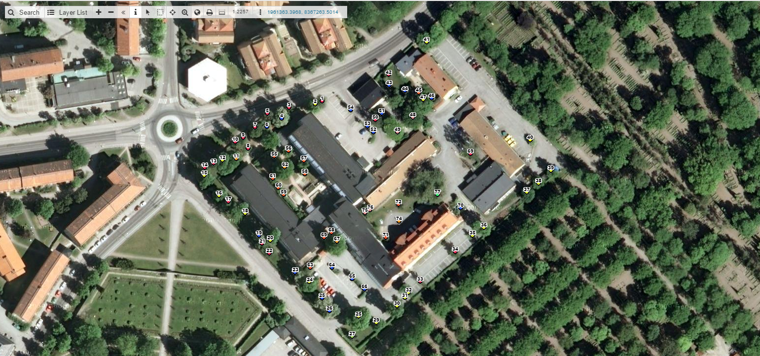
We did an interview with Sean Grant with the Vivaldi Arborists from Sweden that have been using GIS Cloud apps in their workflow.
BACKGROUND
GIS Cloud: Can you give us some basic information about projects you are doing and why was there a need for a cloud based solution?
Sean Grant: I find GIS Cloud useful for both short term and long term projects within my work as an arborist and group leader in Stockholm, Sweden.
Larger projects include carrying out tree inventories and subsequent tree care plans. The tree data is collected quickly with the MDC app and a photo database can be kept of injuries to the trees to be followed up or other important visual information which doesn’t necessarily need to be included in the protocol but is otherwise important to have available to the customer.
CHALLENGES
What were some challenges that in your opinion you overcame with GIS Cloud apps?
Using the GPS function in my mobile device has also proven problematic but the MDC pinpoint function allows me to select the exact position of the tree which can often be seen in the MDC base map.
Being able to export the layers in common GIS file formats is also important in case, for example, the data is to be analyzed in another program or the dbf used to be used create graphs in Excel.

SOLUTION
Is your project workflow more efficient with GIS Cloud apps and how?
My work flow is much more efficient when using the GIS Cloud as a basis for my quotes and work orders and collection of all field data. I can easily find the geographic data I need regardless of when it was collected and allows me to focus more on care for the trees themselves and less on keeping track of all of the data.
I use the Mobile Data Collection app on a daily basis to collect tree information and pictures to be later used for pricing and planning jobs. With the MDC app I can quickly collect the information I need such as species, vitality, risk class and tree care to be carried out. The photo function is invaluable as I often take many pictures which I can refer to later.
Before GIS Cloud it was time consuming to keep track of the pictures. Now using GIS Cloud the pictures are always available and stored in their geographic locations so even if I need to look at them a year later I can search using the Google place search function and my photos are there waiting for me.
When leaving quotes to customers I find that a picture or map in this case, speaks louder than words and with GIS Cloud I can produce maps quickly to be attached to a written quote so there is no question about what is to be carried out. This map is also used as a base to work orders so the correct work is carried out on the correct trees (import when felling trees for obvious reasons.)
RECOMMENDATION
What would be 3 key features in your opinion that you would recommend GIS Cloud for?
I can recommend GIS Cloud for those who don’t have an advanced understanding of GIS (such as those out collecting data) as it is a user-friendly platform and can be accessed from any computer with an internet connection or any mobile device with the downloaded app. I can recommend GIS Cloud where photos attached to geographic location can be helpful in keeping track off asset data. I can recommend GIS Cloud to clearly convey information to customers or employees to avoid mistakes and misunderstandings.
How has GC specifically helped you given your industry and area of expertise?
GIS Cloud has allowed me to streamline the administrative side of work flow which allows me to work more effectively and provide tree care of a higher quality.
Originally published on GIS Cloud blog.


