Geo Addressing Decoded, Part 4: Exploring the Applications of Geo Addressing Solutions

Accurate address data is essential. Precise location information ensures that more deliveries and services arrive on time, reducing losses and improving customer relations. In terms of compliance, correct address data ensures that companies are paying correct taxes and duties for any goods or services they deliver. Having access to digitally versatile and enriched addresses can streamline business processes, improve efficiency, and allow companies to scale more rapidly and expand to new markets.
In our previous articles, we have explored the intricacies of traditional addressing systems, the innovations in geocoding, and the advanced features of Precisely’s Geo Addressing solutions that make them invaluable for any business. In this final part of the series, we will focus on the practical applications of these technologies across some key sectors, and the transformative impact they can have.
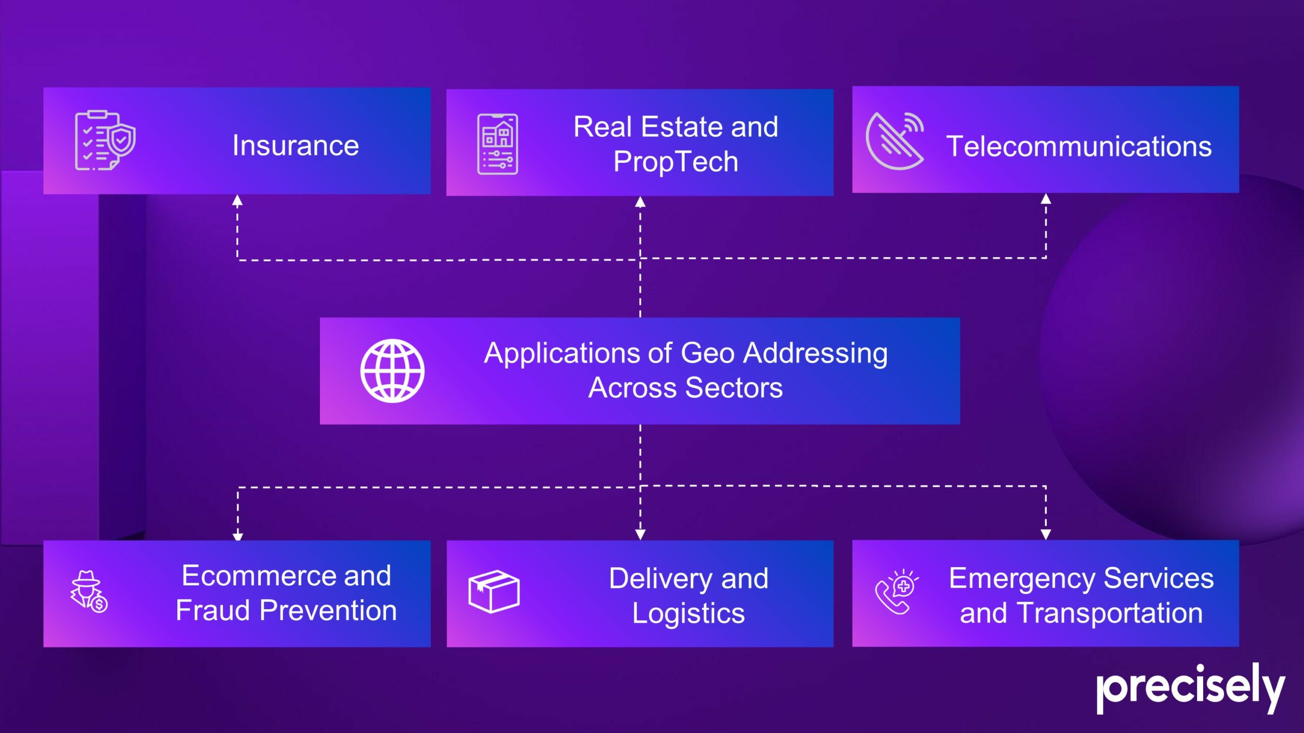
Applications of Geo Addressing Across Sectors
The versatile nature of Precisely’s Geo Addressing solutions and the PreciselyID makes them applicable across a wide range of industries, enabling organizations of all sizes to increase the use of address data and quickly associate rich, relevant information. Using a unique ID allows a company to transform their first-party data, and makes that data easily linkable, with the rest of Precisely’s portfolio of data, driving incremental value and opening new use cases and analysis.
Read More:
Geo Addressing Decoded Part 1: Why Does Geo Addressing Matter?
Geo Addressing Decoded Part 2: Beyond Coordinates – Exploring the Depth and Impact of Geo Addressing
Geo Addressing Decoded Part 3: Diving into the Key Features of Precisely’s Geo Addressing System
Geo Addressing Decoded Part 4: Exploring the Applications of Geo Addressing Solutions
Our first article in this series (‘Why Does Geo Addressing Matter?’) discussed some of the specific sectors that suffer from inadequate addressing systems. Here, we look at how they can benefit from applying Geo Addressing:
Ecommerce and Fraud Prevention:
According to Forbes, 20% of retail purchases are predicted to take place online in 2024. When making a purchase online, a smooth address entry process, using intelligent autocomplete, enhances the customer experience. As previously mentioned, 4% of cart abandonment is due to problematic address entry, and one in five online shoppers have abandoned their cart at some point due to these issues (Baymard Institute 2021). It follows that the quicker a user’s address is accepted by the system, the more likely they are to complete a purchase or registration journey.
According to Forbes, the ecommerce industry was worth $5.3 trillion in 2022, but $41 billion was lost to e-commerce fraud. A Pitney Bowes study from 2019 suggests the losses from failed deliveries reached a massive $333 billion. Precisely’s technology can help mitigate losses from both fraud and failed delivery. Using hyper accurate address validation and verification, makes it much harder for criminals to exploit ecommerce vulnerabilities through address jigging (manipulation of address details) and other fraudulent activities. And, of course, accurate address data ensures that deliveries reach the correct destinations without issues, further improving customer experience and increasing the likelihood of return custom as well as reducing losses.
Delivery and Logistics
According to 2018 data from UPS, the typical cost of mishandling a delivery due to poor addressing can range from $10-$100. Geo Addressing ensures the smooth operation of the delivery chain by providing precise and validated address data. This reduces delays, failed deliveries, and lost packages, ultimately protecting businesses’ profits and reputations. When it comes to the case of hyper-local delivery, as many as one in five jobs are cancelled or late due to location problems (according to 2019 data from Google), but with accurate geocoded addresses, delivery companies can optimize their routing, ensuring timely and efficient deliveries.
Emergency Services and Transportation:
Precise address data is critical for quick and accurate location identification, significantly improving response times during emergencies. Accurate Geo Addressing can literally save lives by enabling first responders to locate individuals in need with speed and accuracy. High accurate address data, also helps in coordinating disaster response efforts, ensuring that all responders have access to the same accurate information.
The stakes may be lower for ride-hailing services like Uber and Lyft, but they too can benefit from more accurate address data. Uber data from 2019 suggests that 10% of drop-offs are missed or delayed due to address location issues, and accurate geocoding (and reverse geocoding) can help to reduce this.
Insurance:
Property and personal insurance companies require high-quality address information to accurately assess risk—currently, 20% of total revenue loss in the industry comes from bad addresses (MIT Sloan). Accurate address data from Precisely allows insurers to properly evaluate risks and set appropriate premiums, while reliable address verification and validation technology help to anticipate and prevent fraudulent claims, ensuring that insurance cover is based on accurate and legitimate information.
From a business strategy point of view, Precisely’s enriched address data enables insurance firms to gain a comprehensive view of aggregate risk. This helps them to inform their broader pricing strategy, and to target and retain the most profitable customers.
Real Estate and PropTech:
The real estate industry obviously needs accurate address data for a range of functions, but according to multiple sources, the industry is currently working with a huge number of missing or incorrect addresses. Precisely’s datasets include detailed information about addresses, with 9,000 attributes covering the neighborhood as well as the property itself, which can be attached to a PreciselyID. This enriched data is invaluable for real estate agents and property managers in making informed decisions related to valuation, and more.
More broadly speaking, high-quality, enriched address information allows real estate businesses to keep abreast of economic development, to improve lifestyle modelling and market analysis, and consequently to make more informed decisions about site selection.
Applications in Telecommunications:
Accurate address information is essential for planning and optimizing telecommunications networks, to ensure efficient service delivery and coverage. Furthermore, when telecommunications companies are expanding networks or capacity, they need to know how many secondary addresses are attached to a primary address—in other words, does an apartment complex contain ten apartments or a thousand? This is key to calculating return on investment (ROI) and the network capacity. Precise geocoded addresses also help telecommunications companies to provide accurate service availability information to customers, which is vital for customer satisfaction.
Applications of Geo Addressing Solutions
The Future of Geo Addressing Applications
The shift from traditional addressing methods to advanced solutions like Precisely’s Geo Addressing technology represents a significant leap towards greater accuracy and utility in addressing. This has the potential to revolutionize address data management across various sectors—advancements in address management don’t simply improve delivery and logistics but also enhance customer experiences, streamline business processes, and impact bottom line.
Precisely’s features are not just about improving current systems but also about envisioning and creating new possibilities, as businesses find unique and powerful use cases for enriched, linkable address data. The potential for even more detailed applications, such as assigning identifiers to specific rooms (in student accommodation for example) points towards a future where every space, no matter how small, can be accurately mapped and identified. Innovations in AI and machine learning are set to further refine geocoding processes, enhancing accuracy and adaptability, as well as enabling the seamless utilization of the vast amount of address data at our disposal.
Address management also has the potential to impact broader aspects of global connectivity and economic development. It’s worth considering societal implications too: the way we name and organize spaces has profound implications for identity, access, and social equity, and addressing systems can therefore mirror societal issues.
Throughout this four-part exploration of Geo Addressing solutions, we’ve looked at the fundamental challenges of traditional systems, explored some of the solutions that have been developed in response, and highlighted the impactful applications of Precisely’s trailblazing technology. We hope this series has provided valuable insights into the essential role of precise addressing in our interconnected world. Thank you for joining us on the journey!
Did you like the article about the Applications of Geo Addressing? Read more and subscribe to our monthly newsletter!


#Featured

Next article

Geospatial technology is revolutionizing the gaming industry by providing highly detailed maps and 3D models that enhance the realism in virtual environments. This technology also plays a role in VR experiences, allowing gamers to explore lifelike worlds that are accurately modeled after real-world locations.
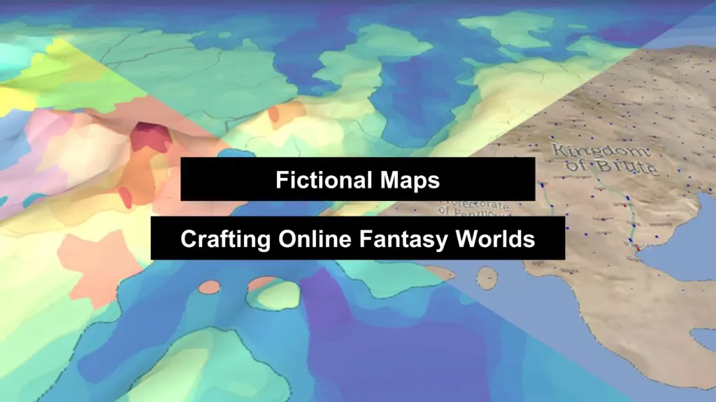
Fictional cartography refers to the creation and representation of fictional worlds through maps and cartographic techniques. It involves the design and visualization of landscapes, environments, and spatial relationships that do not exist in the real world, but in fictional narratives.
Realism in virtual environments
Virtual environments aim to create highly realistic and immersive digital representations of real or imaginary spaces. In the context of cartography and geographic visualization, realism in virtual environments refers to the pursuit of closely mimicking the real world in terms of spatial accuracy and user experience.
Creating fictional maps has now transcended from a niche hobby to a sophisticated art form, facilitated by advanced online tools that combine user-friendly interfaces with rich geospatial features.
These tools, such as those provided by Campfire Writing, World Anvil, Inkarnate, Azgaar’s Fantasy Map Generator, and Ross Thorn’s Interactive Fantasy Maps, offer a range of functionalities that may be satisfying to both amateur storytellers and professional cartographers. For GIS professionals it’s crucial to create high-quality visualizations and map layouts. Storytellers and enthusiasts of fantasy worlds also have similar ambitions.
Let’s explore the cartographic aspects, geospatial features, symbology, and user-friendliness of these platforms, highlighting how they enable the creation of detailed fictional worlds.
Geospatial Features
1. Terrain and Landforms:
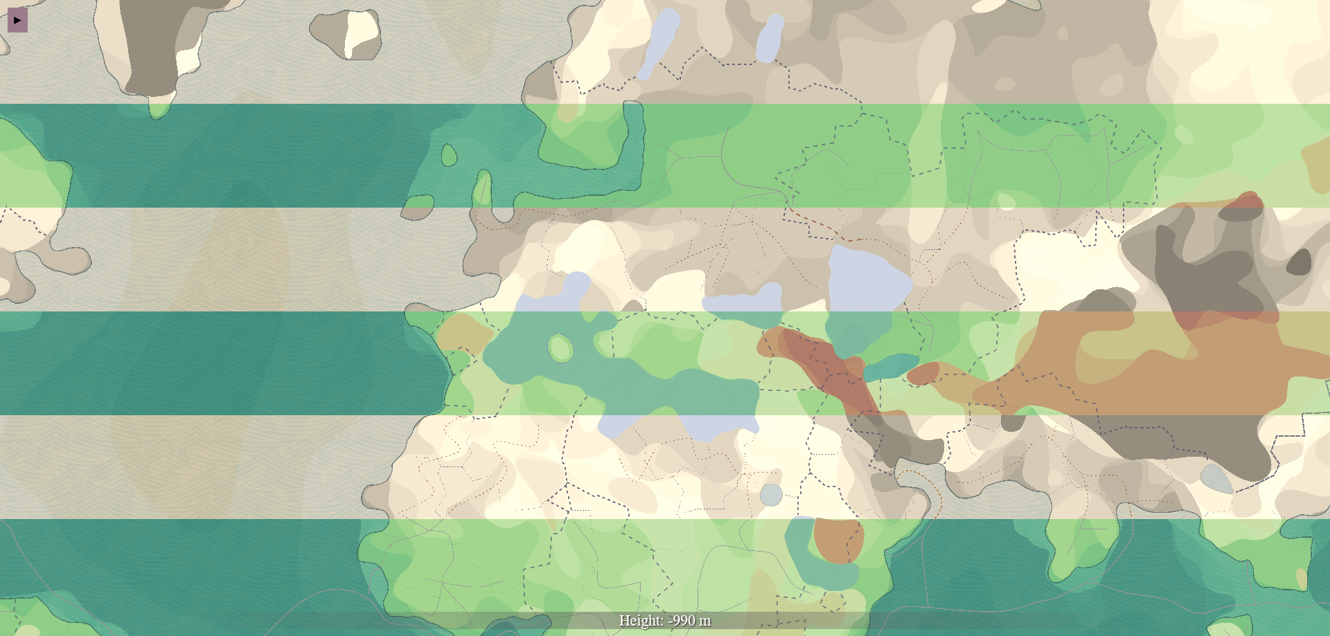
Fictional maps rely heavily on realistic terrain and landforms to create believable worlds. Platforms like Inkarnate and Azgaar’s Fantasy Map Generator provide detailed tools for generating mountains, valleys, rivers, and coastlines. These tools often include height maps and contour lines, allowing users to visualize and manipulate the topography of their fictional landscapes. For example, Azgaar’s generator offers various terrain presets such as archipelagos, peninsulas, and continents, enabling users to create diverse geographical settings with ease.
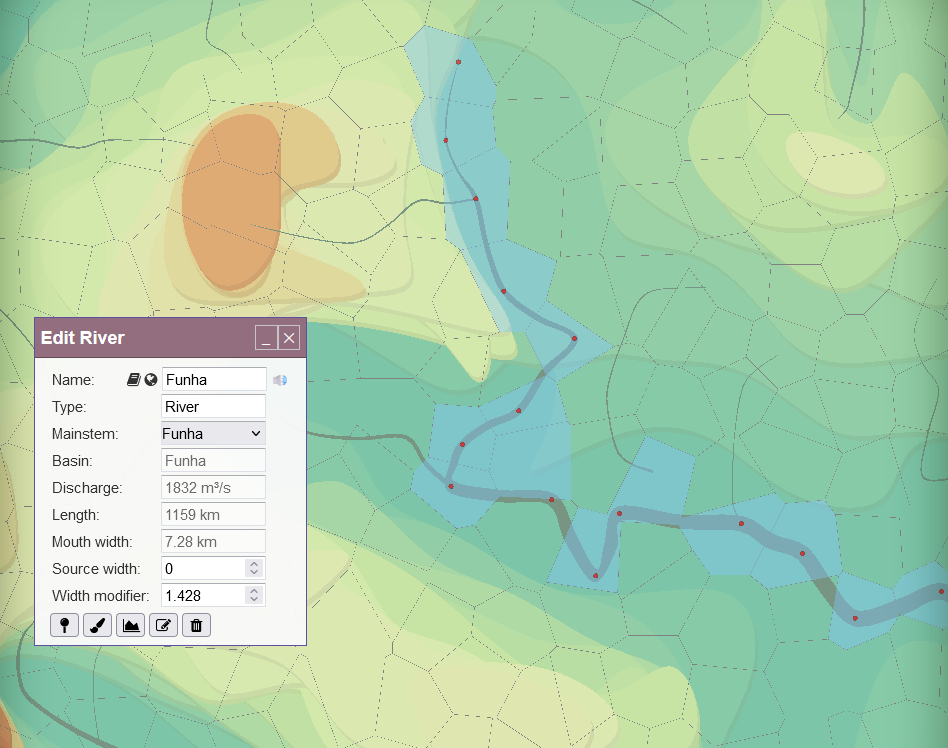
Azgaar’s Fantasy Map Generator – landforms modelling
2. Climate and Biomes:
Accurate representation of climate and biomes is key for adding depth to fictional maps. Azgaar’s Fantasy Map Generator excels in this aspect by allowing users to simulate different climate zones, precipitation patterns, and temperature variations. Users can create maps that reflect realistic ecological systems, from arid deserts to lush forests, enhancing the environmental storytelling of their worlds.
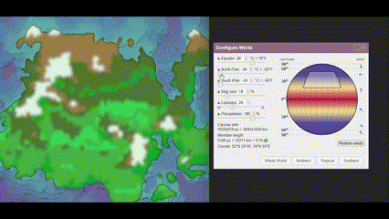
Azgaar’s Fantasy Map Generator – climate modeling
3. Political and Cultural Boundaries:
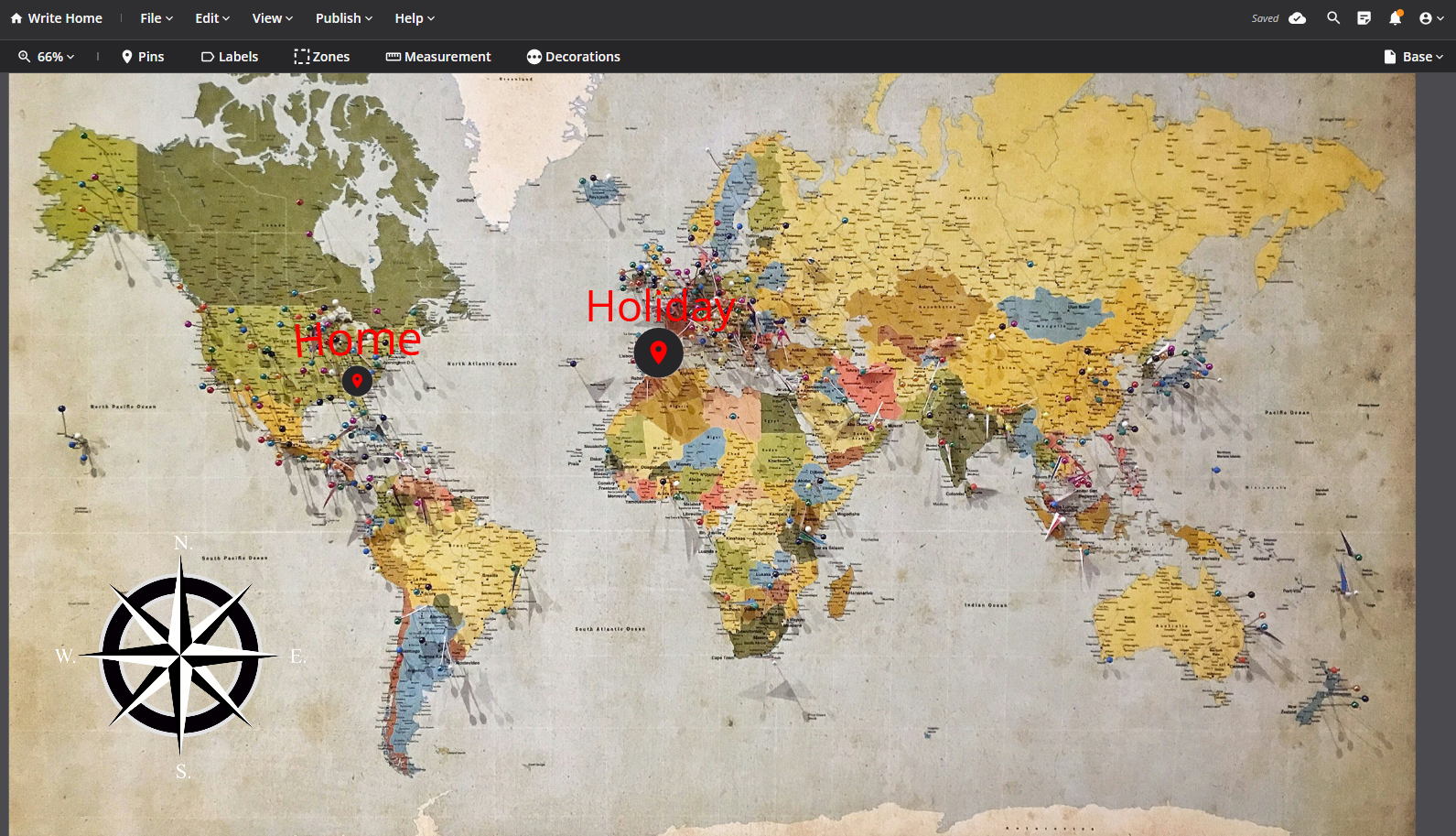
Mapping political and cultural boundaries is essential for worldbuilding in fantasy and science fiction settings. Tools like World Anvil offer features to define and customize states, provinces, and other administrative divisions. These platforms often include options to display cultural regions, languages, and population distributions, providing a comprehensive overview of the societal structure within the fictional world.
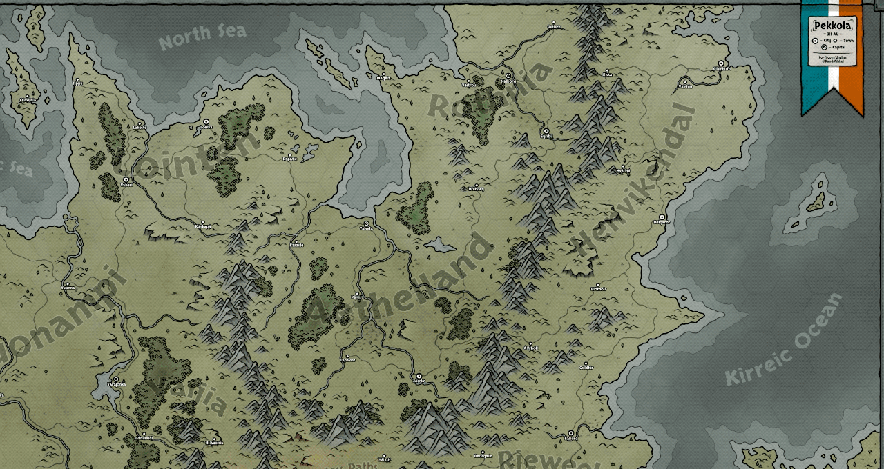
World Anvil – boundaries
Symbology
1. Icons and Markers:
Symbols and markers play a key role in fictional cartography, representing various elements such as cities, castles, forests, and battle sites. Inkarnate and Campfire Writing provide extensive libraries of customizable icons, allowing users to add unique and context-specific symbols to their maps. These icons help convey important information at a glance and enhance the visual appeal of the map.
Campfire Writing – icons
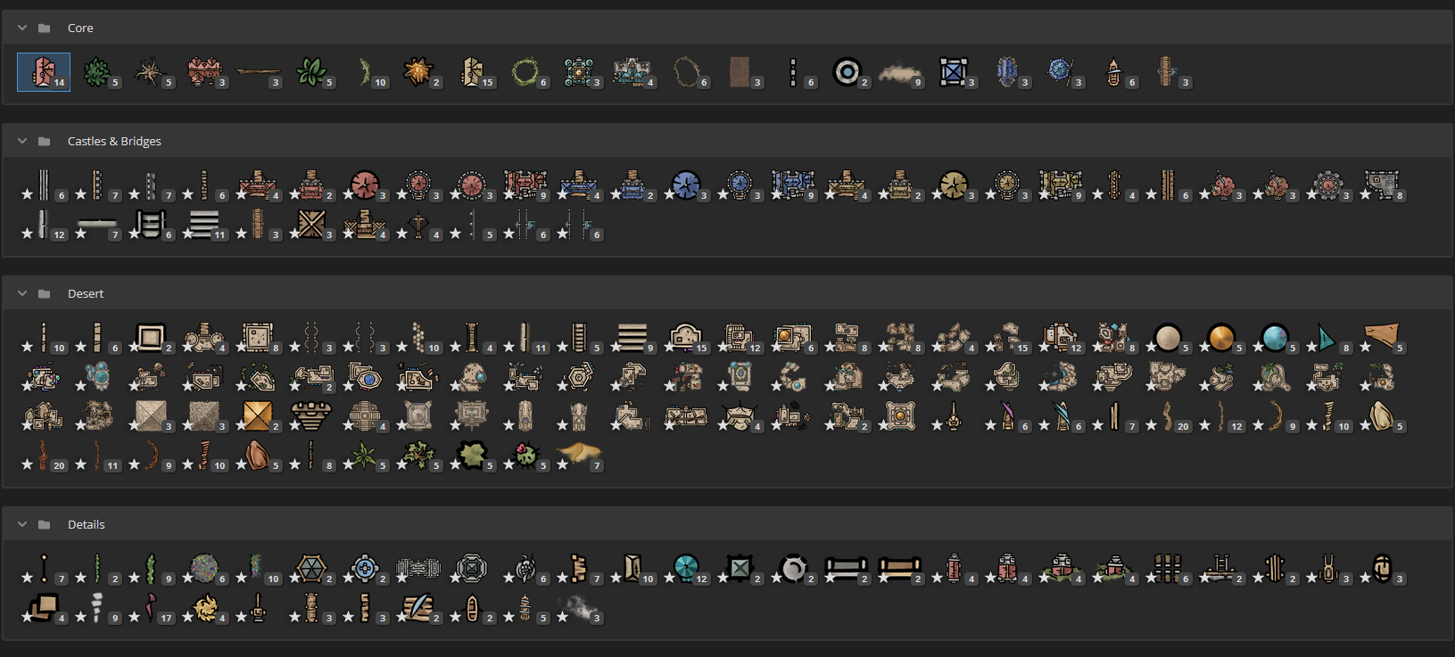
Incarnate – markers
2. Labels and Annotations:
Clear and well-placed labels are essential for the readability of maps. Platforms like Ross Thorn’s Interactive Fantasy Maps and World Anvil offer tools for adding and styling text labels, ensuring that place names, geographical features, and other annotations are easily distinguishable. Customizable font styles, sizes, and colors allow for aesthetic consistency and thematic coherence.
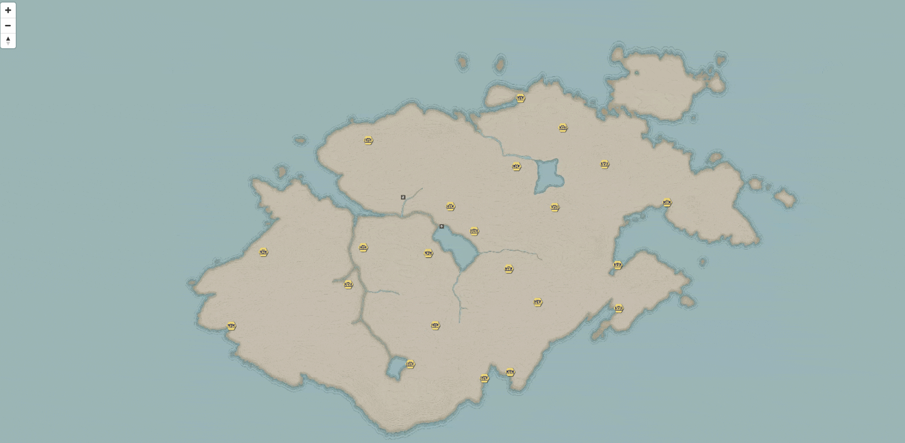
Ross Thorn – labels & annotations
3. Color Schemes and Styles:
The choice of color schemes and map styles significantly impacts the overall look and feel of a fictional map. Tools like Inkarnate and Azgaar’s Fantasy Map Generator provide various style presets, from antique parchment to modern vector graphics. Users can adjust color palettes to match the mood and setting of their worlds, whether it be a dark and foreboding landscape or a vibrant and whimsical realm.
Azgaar’s Fantasy Map Generator – map styles
User-Friendliness
1. Intuitive Interfaces:
User-friendly interfaces are paramount for making complex cartographic tools accessible to a broad audience. Platforms like Inkarnate and Campfire Writing excel in providing intuitive drag-and-drop functionalities, real-time previews, and straightforward navigation. These features lower the learning curve, allowing users to focus on creativity rather than technical details.
Campfire Writing
2. Customization and Flexibility:
The ability to customize and tweak every aspect of a map is a key feature of advanced cartographic tools. World Anvil and Azgaar’s Fantasy Map Generator offer extensive customization options, from modifying terrain features to creating custom symbols and color schemes. This flexibility ensures that users can create maps that are uniquely tailored to their storytelling needs.
3. Collaboration and Sharing:
Modern map-making platforms often include features for collaboration and sharing, enabling multiple users to work on a map simultaneously. World Anvil, for example, allows creators to share their maps with collaborators, making it easier to develop complex worlds in a team setting. Additionally, tools like Campfire Writing provide options to export maps in various formats, facilitating easy integration into other storytelling platforms or print media.
Incarnate – sharing
Campfire Writing – sharing
Conclusion
The creation of fictional maps has evolved into a sophisticated practice, thanks to the advanced features offered by online tools. By focusing on geospatial features, symbology, and user-friendliness, platforms like those mentioned in this article enable users to craft detailed, immersive, and visually appealing maps.
Whether for storytelling, gaming, or enjoyment, these tools empower users to bring their fictional worlds to life with ease and precision.
For more detailed explorations and tutorials, visit the respective platforms:
– Azgaar’s Fantasy Map Generator
– Ross Thorn’s Interactive Fantasy Maps
To explore map- and location-based games, take a look at the Top Google Maps & Map-Based Games of All Time.
Did you like this post? Read more and subscribe to our monthly newsletter!

