CubeSats in Deep-Space: ESA’s Asteroid Mission offers the ultimate hitchhiking opportunity

The European Space Agency is offering the “ultimate hitchhiking opportunity”; the agency plans to carry 6 CubeSats onboard its Asteroid Impact Mission (AIM) that is scheduled for 2020.

Team of researchers and companies from ESA member states are free to compete as part of ESA’s SysNova competetion to put their CubeSat in deep-space. So if you have an innovative idea for CubeSat onboard a deep-space Asteroid mission that will help improve the Missions’ scientific returns, this is THE competition! CubeSats in deep space!!! Not for nothing is ESA calling it the “ultimate hitchhiking opportunity”.

CubeSats in Deep Space

CubeSats are among the smallest types of satellites with a 10 cm cubical structure, providing affordable access to space for universities, research organizations and satellite start-ups like SkyBox, Planet Labs, Spire and more (Read: How Earth Observation Startups and CubeSats are changing the Industry). Till date, CubeSats have mostly been deployed in low earth orbits and this mission could well be the first one to propose to have CubeSats in Deep-Space, opening up a whole new opportunity for CubeSats.

Considering the fact that the size of a solar panel that can accommodated on the CubeSat is rather small and usually in a deep-space mission, the satellites’ receive a fraction of the solar energy that they would in a low earth orbit, which means there would be lesser energy in total to power the sensors. It would be interesting to see how the trade-off between power requirements and sensors onboard a CubeSat in a Deep-Space mission is approached.

“AIM has room for a total of six CubeSat units,” explains Ian Carnelli, managing the mission for ESA. “So potentially that might mean six different one-unit CubeSats could fly, but in practice it might turn out that two three-unit CubeSats will be needed to produce meaningful scientific return. – ESA Press Release
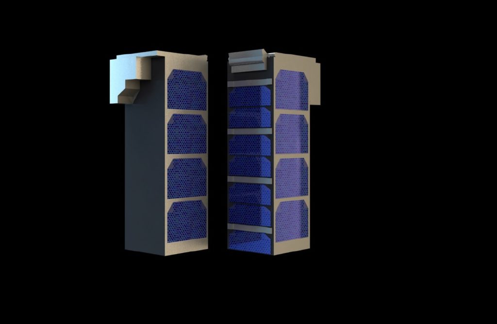
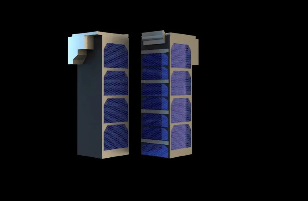
A pair of triple-unit CubeSats. ESA's 2020 Asteroid Impact Mission spacecraft will have room to carry six CubeSat units – potentially single-unit miniature spacecraft but more probably a pair of larger CubeSats as seen here.

A pair of triple-unit CubeSats. ESA’s 2020 Asteroid Impact Mission spacecraft will have room to carry six CubeSat units – potentially single-unit miniature spacecraft but more probably a pair of larger CubeSats as seen here.

Asteroid Impact Mission (AIM)

The mission is humanity’s first mission to a binary system – the paired Didymos asteroids and is part of the larger NASA-led mission – Asteroid Impact & Deflection Assessment (AIDA) mission to explore technologies that could one day address planetary defense questions i.e. protecting earth from asteroids.

The NASA-led Double Asteroid Redirection Test (DART) probe will impact the smaller body, while AIM will perform detailed before-and-after mapping, including pinpointing any shift in the asteroid’s orbit. – ESA

Source: CubeSats offered deep-space ride on ESA asteroid probe


Did you like this post? Read more and subscribe to our monthly newsletter!

Say thanks for this article (0)
The community is supported by:
Become a sponsor
#
#News #Science
Current Trends in Geospatial and Remote Sensing Research: A Review of Recent Scientific Literature
Sebastian Walczak & Nikita Marwaha Kraetzig 10.9.2024
AWESOME 6
#Featured #Ground stations #Satellites
Ground Stations Explained: How Does Satellite Data Travel from Space to Earth?
Nikita Marwaha Kraetzig 02.29.2024
AWESOME 9
#0.30m #Airbus #Construction #Drones #Environment #Featured #Maxar #Optical #Science
Bridging the Gap: How Buying Satellite and Drone Data is Evolving
Aleks Buczkowski 02.1.2024
AWESOME 5
Next article

Mapping the Moon: The Jumping-Off Point in GIS Space Exploration

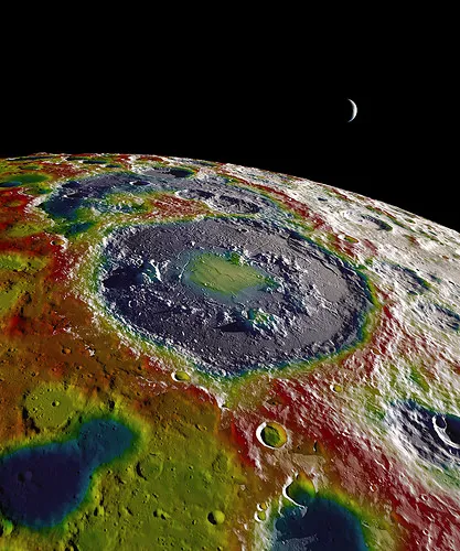
Mapping the Moon

Mapping the Moon: Image by NASA Goddard Space Flight Center

The power of geographic information systems (GIS) is undisputed in every field it has been applied to. From climatologists using the software to determine the impacts of climate change to epidemiologists tracking the spread of disease outbreaks like Ebola, GIS has been used to improve the quality of our lives and help to inform important decisions. Now, this technology is helping scientists to explore things outside of our planet, mapping the Moon. GIS is now being used to explore space.

Like many newer ventures, starting near home is where the most progress is initially made. In the mid to late 1990s the Celmentine spacecraft was launched with the a large amount of equipment to be used to extensively photograph the moon. This effort produced many high resolution photos of the geography of the moon. However, it would take the combined work of two GIS specialists, the Behee brothers, to analyze these and remotely sensed topographic data to create a geographic map of the near side of the moon.

Since that time, the use of geographic information science to study the moon has taken off. In 2012, the United States’s NASA began another moon mission called the Gravity Recovery and Interior Laboratory (GRAIL).

The goal of the GRAIL mission was to extensively study lunar gravity and help scientists more fully understand how rocky planets were formed. This was done by using two twin spacecrafts that essentially chased each other around the moon. Based upon the strength of the gravitational pull, the distance between the two would change.

This data allowed scientists to map the gravitational pull of the moon and determine the types of rocks that were likely forming the crust. The spacecrafts were also able to collect a significant amount of other topographical data that enabled researchers to estimate the thickness of the moon’s crust and added data to our knowledge of the moon’s thermal history.

NASA’s Scientific Visualization Studio has been using all of this information to produce a number of colorful maps of the moon that have made it much easier to visualize all of the results and learn from them. Data collected from this mission are still being analyzed and new results are released periodically.

Successes related to this work have encouraged GIS-based space exploration on a much larger scale. Recent work, especially on Mars, has resulted in many high resolution images that are being analyzed by GIS specialists to create topographic maps of the planet. Additionally, Mercury crater deposits, Venus topography, and a general map of the locations of stars have been worked on.

All of these extensive data sets help us to better understand how the Earth came to be and it enriches our understanding of our place within the universe. Furthermore, using GIS in space exploration extends our knowledge as to our capabilities of survival outside of Earth’s atmosphere. These exciting discoveries are only the beginning, and the future looks very bright.


Did you like this post? Read more and subscribe to our monthly newsletter!

Read on
Search