Capella Space unveils first commercial SAR images from Sequoia satellite

San Francisco-based geospatial startup Capella Space has unveiled the first commercial SAR images captured by its recently-launched Sequoia satellite. Giving customers immediate access to sub-0.5-meter rapid coverage of regions such as the Middle East, Korea, Japan, Europe, South East Asia, Africa, and the US, Capella Space has become the first American SAR operator. When fully deployed, Capella’s satellite constellation will offer hourly coverage of every point on Earth.
Capella Space - commercial SAR imagery

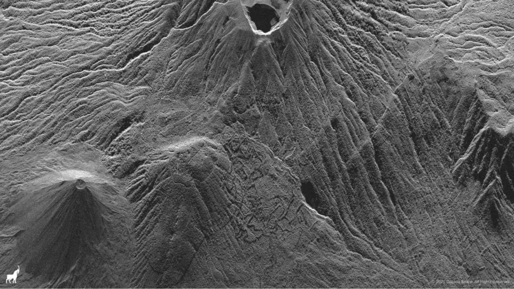
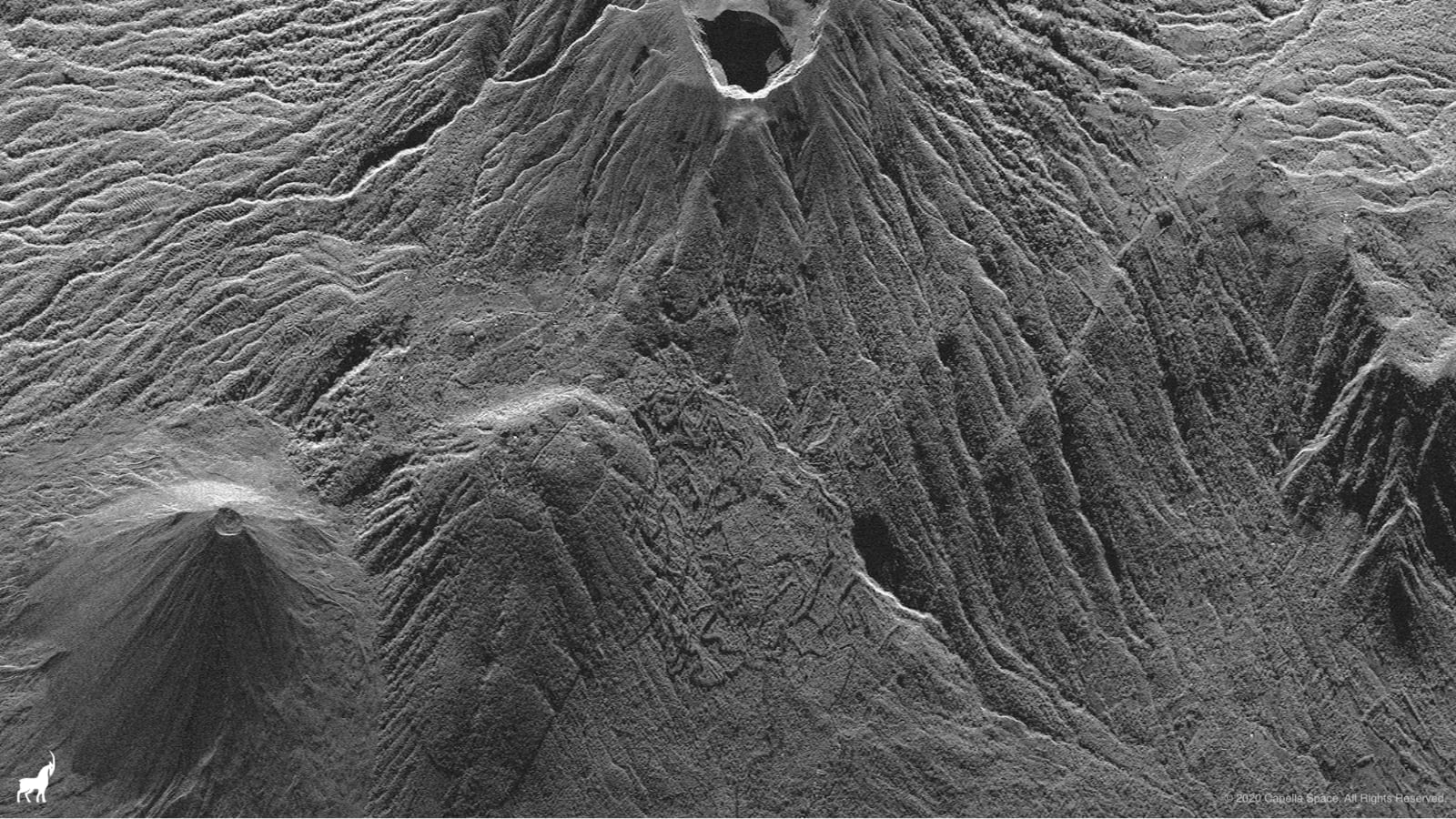
In this Strip image of Santa Ana Volcano, the geometrical patterns of the terraced gardens of Lomas de San Marcelino can be seen beneath the backdrop of the towering Volcan de Santa Ana O Ilamatepec. Courtesy: Capella Space

“When I started Capella Space in 2016, there were a number of European providers operating and building commercial SAR, but the United States had no horse in the commercial SAR race,” Payam Banazadeh, CEO and Founder of Capella Space, explains.

“Capella decided to change that dynamic, and challenge the international competition by bringing a fully American designed, built and operated capability to market. Today we accomplished that goal and we can proudly say we are the first American SAR operator.”

What is SAR?

NASA has been using Synthetic Aperture Radar (SAR) technology since the 1970s to detect sub-meter changes to the Earth’s surface, but SAR is not the first thing that comes to mind when you talk about satellite data. Most people envision an optical image – or a photograph taken by a very powerful camera utilizing the light from the sun. SAR, meanwhile, uses radio waves to create an image.

The radio waves used in SAR typically range from approx. 3 cm up to a few meters in wavelength, which is much longer than the wavelength of visible light, used in making optical images. These wavelengths fall within the microwave part of the spectrum.

Over the years, scientists have experimented with different wavelengths for SAR and determined that utilizing X-band microwaves and large bandwidth makes it possible to achieve excellent ground range resolution. The high resolution of X-band SAR and excellent contrast achieved through a process called multi-looking can yield imagery that is uniquely suitable for object detection and recognition using computer vision and machine learning.

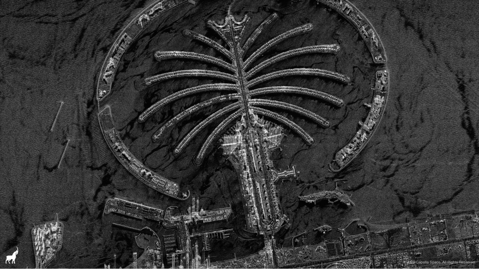
In the below image, for example, individual balconies of the tall buildings on either side of the Nakheel Mall, Palm Jumeirah, Dubai are visible, as are the boats moored at the docks behind the buildings.
Capella Space - commercial SAR imagery

Courtesy: Capella Space

Why use SAR for earth observation

SAR can see through clouds, in all weather conditions and even at night – making it enormously useful for a wide variety of use cases, including persistent monitoring of facilities for defense and intelligence, verifying damage claims for insurance, detection of illegal activities for maritime, mapping natural disaster damage for humanitarian aid, and infrastructure security for the oil and gas sector.

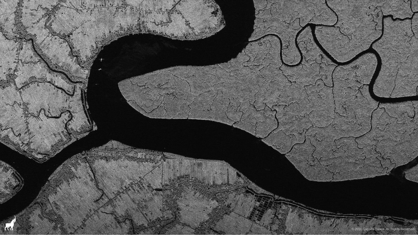
For example, in the image below, the Mangrove forest of the Indian Sundarbans (right-hand side of the river) is starkly contrasted with the harvested land on the left-hand side of the river. The remains of the original Mangrove forest can be seen along the banks of the river at the ends of the strips of plowed fields. A number of boats are visible along the river.
Capella Space - commercial SAR imagery

Courtesy: Capella Space

Tree counts, deforestation, and biomass are the three key applications that can be derived from this image in a region notorious for the cloudiness and monsoons that prevent optical imaging.


Did you like the article? Read more and subscribe to our monthly newsletter!

Say thanks for this article (1)
The community is supported by:
Become a sponsor
#
#Featured #Ground stations #Satellites
Ground Stations Explained: How Does Satellite Data Travel from Space to Earth?
Nikita Marwaha Kraetzig 02.29.2024
AWESOME 9
#Agriculture #Construction #Energy #Environment #Environmental Protection #Financial Services #GeoDev #Government #Humanitarian #Ideas #Natural Resources #Orthorectification #Satellites #Transportation
Why Orthorectification is Key for Real-World Terrain Mapping and How To Use It
Nikita Marwaha Kraetzig 10.14.2024
AWESOME 2
#News #Science
Current Trends in Geospatial and Remote Sensing Research: A Review of Recent Scientific Literature
Sebastian Walczak & Nikita Marwaha Kraetzig 10.9.2024
AWESOME 6
Next article

Norway is revolutionizing global deforestation monitoring with free satellite data

satellite data deforestation

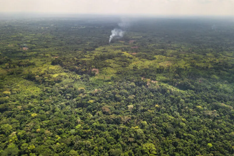
Fields bordering the forest near Yangambi, DRC. Courtesy: NICFI

Norway’s reputation as a climate champion is no secret. Under a mix of United Nations and bilateral schemes, the country has set aside up to $350 million a year for a decade to help save rainforests and improve the livelihoods of those who live there.

In June 2019, Norway announced that it would commission high-resolution satellite images of the Amazon and other rainforests for the next four years to help with the tricky task of detecting tropical deforestation. This week, Norway’s Ministry of Climate and Environment (NICFI) entered into a contract with Kongsberg Satellite Services (KSAT), and its partners Airbus and Planet, to make good on that promise.

“This will revolutionize global forest monitoring,” says Sveinung Rotevatn, Norway’s Minister of Climate and Environment, pointing to how the fight to combat deforestation and forest crime is more important than ever before.

In 2019, the world lost 3.8 million hectares of tropical primary forests – equaling approximately a soccer pitch every six seconds or an area the size of Switzerland in total. Early-warning satellite data can help check the rate of deforestation. But these images are typically very expensive and only a few private stakeholders have access to them.

NICFI’s new contract, valued up to $43.5 million, will allow anyone around the world to access high-res satellite imagery data, archived back to 2015, to detect deforestation occurring in the smallest of geographical areas.

The data will be updated every month, empowering government authorities, companies buying raw materials associated with deforestation, investors, journalists, scientists, indigenous organizations, and NGOs with detailed observations into priceless forest ecosystems.

satellite data deforestation

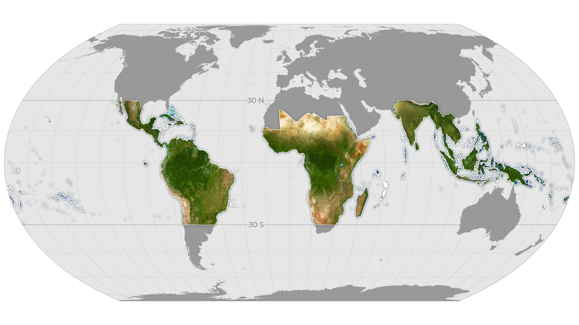
Global map showing the extent of monthly Planet Basemaps to be provided through the partnership for tropical forest monitoring. Courtesy: Planet

“Small communities can now be seen and heard in their struggle with companies that steal their rightful territories. The world’s supermarkets can monitor claims made by their suppliers regarding the sustainable production of soy, palm oil, and other raw materials”, quips Rotevatn.

As part of this unique and distinct partnership, Planet will provide KSAT with high-resolution (sub-5m per pixel) Basemaps of the full tropics, covering over 64 developing countries. The subcontractor will also allow anyone to download the analysis-ready monthly Basemaps of these regions.

“Revolutionizing satellite data so we could see deforestation happening fast enough to stop it was one of the key reasons we founded Planet nine years ago,” says Will Marshall, CEO and co-founder of Planet. “Norway has taken a systematic approach to measure natural capital in the key area of tropical forests, demonstrating the way to enable the transition to a sustainable economy.”

Airbus, meanwhile, will bring its huge archive of SPOT high-resolution imagery to the table, enabling a unique historical perspective into forest monitoring. François Lombard, Head of Intelligence Business at Airbus Defence and Space, says, “Our satellites have been monitoring the Earth for over thirty-five years, supporting a wide range of environmental initiatives fighting deforestation. Our unique library of millions of square kilometers of imagery, built over decades, is a key asset in the fight against deforestation.”

The service is expected to launch in October 2020.


Did you like the article? Read more and subscribe to our monthly newsletter!

Read on
Search